
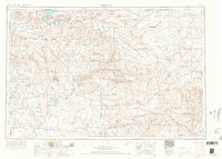
1954 Map of Vernal
USGS Topo · Published 1966About this map
The Green River carves a dramatic path through the landscape of the eastern Uinta Basin, defining the rugged geography of Dinosaur National Monument and the recently formed Flaming Gorge Reservoir. As a regional hub, Vernal stands at the center of a network of smaller agricultural and industrial outposts like Jensen, Maeser, and Naples. The map illustrates the region's mid-century economic character, from the ranching lands within the Ashley National Forest to the burgeoning petroleum industry evidenced by Oil wells and a Coking plant near Little Bonanza. To the south and west, the Uintah and Ouray Indian Reservation encompasses vast tracts of the basin, including the river valleys of the White River and the Wonsits Valley. This 1954 survey, with revisions through the mid-1960s, documents the era before massive modern development, showing the transition from isolated frontier settlements to a connected resource-extraction economy.
Find a feature on this map
91 named features on this map. Tap any name to fly to it.
Don’t see what you’re looking for? This feature index may not catch every label — zoom into the map to look around manually.
Map Details
Editions of this 1954 Vernal Map
4 editions found
Other maps of this area

1885 · East Tavaputs
USGS Topo · 1:250,000

1885 · Ashley
USGS Topo · 1:250,000

1885 · Uinta
USGS Topo · 1:250,000

1886 · Price River
USGS Topo · 1:250,000

1896 · Price River
USGS Topo · 1:250,000

1905 · Gilbert Peak
USGS Topo · 1:125,000

1906 · Gilbert Peak
USGS Topo · 1:125,000

1906 · Marsh Peak
USGS Topo · 1:125,000

1906 · Grand Hogback
USGS Topo · 1:125,000

1907 · Rangely
USGS Topo · 1:125,000