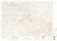
1954 Map of Vernal
USGS Topo · Published 1966About this map
The high desert and mountain intersection of northeastern Utah and northwestern Colorado come into sharp focus in this mid-century survey. Vernal serves as the regional anchor, situated just west of the sprawling Dinosaur National Monument and the dramatic canyon country formed by the Green River and Yampa River. The landscape is a complex patchwork of federal and tribal lands, including the extensive Uintah and Ouray Indian Reservation and the high peaks of the Ashley National Forest, featuring landmarks like Leidy Peak and Marsh Peak.
Find a feature on this map
128 named features on this map. Tap any name to fly to it.
Don’t see what you’re looking for? This feature index may not catch every label — zoom into the map to look around manually.
Map Details
Editions of this 1954 Vernal Map
4 editions found

Other maps of this area

1885 · East Tavaputs
USGS Topo · 1:250,000

1885 · Ashley
USGS Topo · 1:250,000

1885 · Uinta
USGS Topo · 1:250,000

1886 · Price River
USGS Topo · 1:250,000

1896 · Price River
USGS Topo · 1:250,000

1905 · Gilbert Peak
USGS Topo · 1:125,000

1906 · Gilbert Peak
USGS Topo · 1:125,000

1906 · Marsh Peak
USGS Topo · 1:125,000

1906 · Grand Hogback
USGS Topo · 1:125,000

1907 · Rangely
USGS Topo · 1:125,000