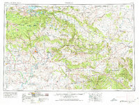
1954 Map of Vernal
USGS Topo · Published 1974About this map
Ashley Valley serves as the agricultural and population hub of this region, anchored by the settlement of Vernal. The landscape transitions from the high peaks of the Ashley National Forest, including Marsh Peak, down to the river-cut canyons of the Green River and Yampa River. Significant land use patterns are visible through the extensive Uintah and Ouray Indian Reservation and the protected lands of Dinosaur National Monument, where the Dinosaur National Monument Headquarters is noted. Water management is a defining theme, shown by the Flamingo Gorge Reservoir and various smaller irrigation works like Paradise Park Reservoir. The map also records industry and frontier outposts, from the mining area of Bonanza to the historical site of Fort Duchesne, illustrating the complex mix of recreation, extraction, and indigenous land rights in the mid-20th century.
Find a feature on this map
109 named features on this map. Tap any name to fly to it.
Don’t see what you’re looking for? This feature index may not catch every label — zoom into the map to look around manually.
Map Details
Editions of this 1954 Vernal Map
4 editions found

Other maps of this area

1885 · East Tavaputs
USGS Topo · 1:250,000

1885 · Ashley
USGS Topo · 1:250,000

1885 · Uinta
USGS Topo · 1:250,000

1886 · Price River
USGS Topo · 1:250,000

1896 · Price River
USGS Topo · 1:250,000

1905 · Gilbert Peak
USGS Topo · 1:125,000

1906 · Gilbert Peak
USGS Topo · 1:125,000

1906 · Marsh Peak
USGS Topo · 1:125,000

1906 · Grand Hogback
USGS Topo · 1:125,000

1907 · Rangely
USGS Topo · 1:125,000