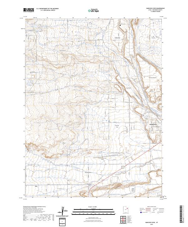
2023 Map of Hancock Cove
USGS Topo · Published 2023About this map
The high desert landscape of Duchesne County unfolds through a sophisticated network of irrigation and water management, centered on the communities of Roosevelt and Hancock Cove. This modern survey documents the vital water infrastructure that sustains the Uinta Basin, including the Cedarview Canal, Page Canal, and Hancock Lateral. These engineered waterways follow the contours of the terrain, specifically serving the flat agricultural expanses of Harmston Bench and Page Bench. To the north, the settlement of Cedarview and its associated Cedarview Cem provide a focal point for genealogical research, while the Roosevelt Municipal Airport and a grid of rural roads like Bluebell Rd mark the modern footprint of the region. The map also captures the natural drainage systems of Dry Gulch Creek and Cottonwood Creek, which contrast with the straight lines of the man-made laterals and canals.
Find a feature on this map
78 named features on this map. Tap any name to fly to it.
Don’t see what you’re looking for? This feature index may not catch every label — zoom into the map to look around manually.
Map Details
Editions of this 2023 Hancock Cove Map
This is the sole edition of this map. No revisions or reprints were ever made.
Other maps of this area

1885 · Ashley
USGS Topo · 1:250,000

1885 · Uinta
USGS Topo · 1:250,000

1917 · Vernal
USGS Topo · 1:125,000

1939 · Duchesne
USGS Topo · 1:125,000

1954 · Salt Lake City
USGS Topo · 1:250,000

1954 · Vernal
USGS Topo · 1:250,000

1958 · Vernal
USGS Topo · 1:250,000

1958 · Salt Lake City
USGS Topo · 1:250,000

1960 · Salt Lake City
USGS Topo · 1:250,000

1960 · Vernal
USGS Topo · 1:250,000