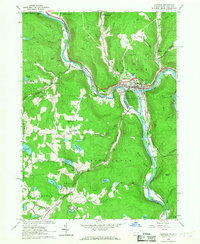
1965 Map of Hancock
USGS Topo · Published 1967About this map
The West Branch Delaware River and East Branch Delaware River converge at Hancock, a central hub in this borderland between New York and Pennsylvania. In the mid-1960s, the landscape is defined by the steep elevation of Hawks Nest and Coon Hill, which forced development into the narrow river valleys. The Erie-Lackawanna Railroad traces these watercourses, serving established settlements like Cadosia and Stockport.
Find a feature on this map
62 named features on this map. Tap any name to fly to it.
Don’t see what you’re looking for? This feature index may not catch every label — zoom into the map to look around manually.
Map Details
Editions of this 1965 Hancock Map
3 editions found
Other maps of this area

1920 · Long Eddy
USGS Topo · 1:62,500

1921 · Long Eddy
USGS Topo · 1:48,000

1923 · Long Eddy
USGS Topo · 1:62,500

1923 · Walton
USGS Topo · 1:48,000

1924 · Starrucca
USGS Topo · 1:48,000

1924 · Deposit
USGS Topo · 1:62,500

1925 · Walton
USGS Topo · 1:62,500

1926 · Deposit
USGS Topo · 1:62,500

1926 · Starrucca
USGS Topo · 1:62,500

1930 · Starrucca
USGS Topo · 1:48,000