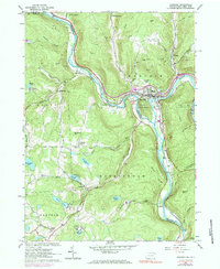
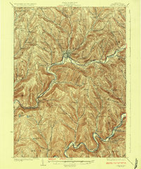
1965 Map of Hancock
USGS Topo · Published 1984About this map
The West Branch Delaware River and East Branch Delaware River converge at the town of Hancock, a significant rail and water hub on the border of Pennsylvania and New York. This 1960s landscape is defined by the Erie-Lackawanna railroad winding through the river valleys, serving timber and industrial operations evidenced by numerous quarries and gravel pits. The map details a transition from the structured streets of Hancock, featuring the Hancock High Sch and Riverview Cem, to the rural hamlets of Starlight and Preston Park to the south. Notable local landmarks like the Mausoleum at Point Mountain and the B'nai B'rith Camp near Mud Pond reflect the region's mid-century role as a destination for both industry and recreation, while the State Forest Preserve highlights the protected wilderness surrounding these river-valley settlements.
Find a feature on this map
66 named features on this map. Tap any name to fly to it.
Don’t see what you’re looking for? This feature index may not catch every label — zoom into the map to look around manually.
Map Details
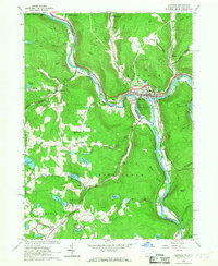
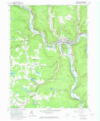
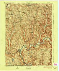
Editions of this 1965 Hancock Map
3 editions found
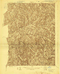
Other maps of this area

1920 · Long Eddy
USGS Topo · 1:62,500

1921 · Long Eddy
USGS Topo · 1:48,000

1923 · Long Eddy
USGS Topo · 1:62,500
1923 · Walton
USGS Topo · 1:48,000

1924 · Starrucca
USGS Topo · 1:48,000

1924 · Deposit
USGS Topo · 1:62,500
1925 · Walton
USGS Topo · 1:62,500
1926 · Deposit
USGS Topo · 1:62,500

1926 · Starrucca
USGS Topo · 1:62,500

1930 · Starrucca
USGS Topo · 1:48,000