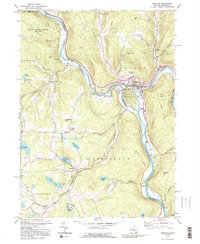
1992 Map of Hancock
USGS Topo · Published 1995About this map
The confluence of the West Branch Delaware River and East Branch Delaware River at Hancock serves as the focal point of this regional study. As the waters merge to form the Delaware River, the landscape is defined by the sharp valley of Point Mountain and the prominent New York Pennsylvania rail line tracking the river’s edge. The settlement pattern reflects the area's river-and-rail history, with nodes of activity at Cadosia, Balls Eddy, and the upland community of Autumn Leaves.
Find a feature on this map
58 named features on this map. Tap any name to fly to it.
Don’t see what you’re looking for? This feature index may not catch every label — zoom into the map to look around manually.
Map Details
Editions of this 1992 Hancock Map
2 editions found
Other maps of this area

1920 · Long Eddy
USGS Topo · 1:62,500

1921 · Long Eddy
USGS Topo · 1:48,000

1923 · Long Eddy
USGS Topo · 1:62,500

1923 · Walton
USGS Topo · 1:48,000

1924 · Starrucca
USGS Topo · 1:48,000

1924 · Deposit
USGS Topo · 1:62,500

1925 · Walton
USGS Topo · 1:62,500

1926 · Deposit
USGS Topo · 1:62,500

1926 · Starrucca
USGS Topo · 1:62,500

1930 · Starrucca
USGS Topo · 1:48,000