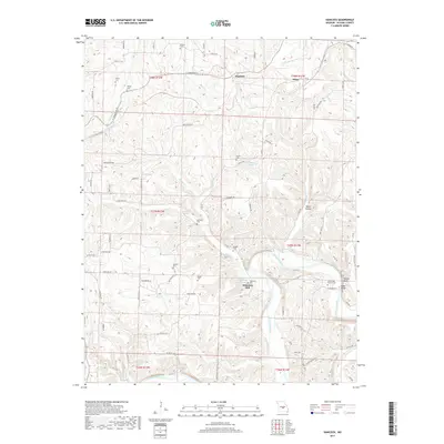
2017 Map of Hancock
USGS Topo · Published 2017About this map
The winding Gasconade River anchors this study of Pulaski County, where the river's deep bends create a complex landscape of bluffs and hollows. Near the water, the site of Wheelers Mill sits adjacent to Wheeler Lake Spring, reflecting a history of small-scale industry and resource use in the rural Ozarks. The map reveals a dense network of family and community burial sites, including the Joiner Cem, Lipscomb Cem, and Brake Cem, which serve as vital markers for genealogical research in this part of Missouri.
Find a feature on this map
65 named features on this map. Tap any name to fly to it.
Don’t see what you’re looking for? This feature index may not catch every label — zoom into the map to look around manually.
Map Details
Editions of this 2017 Hancock Map
This is the sole edition of this map. No revisions or reprints were ever made.
Other maps of this area

1888 · Tuscumbia
USGS Topo · 1:125,000

1894 · Tuscumbia
USGS Topo · 1:125,000

1933 · Iberia
USGS Topo · 1:62,500

1936 · Waynesville
USGS Topo · 1:48,000

1937 · Iberia
USGS Topo · 1:62,500

1942 · Waynesville
USGS Topo · 1:62,500

1943 · Richland
USGS Topo · 1:62,500

1944 · Waynesville
USGS Topo · 1:62,500

1947 · Jefferson City
USGS Topo · 1:250,000

1948 · Tavern
USGS Topo · 1:62,500