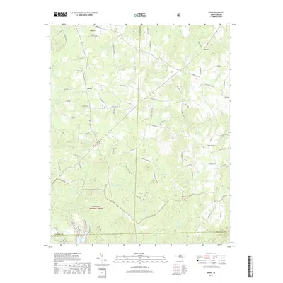
2019 Map of Handy
USGS Topo · Published 2019About this map
Uwharrie National Forest dominates the southern reaches of this landscape, where the terrain begins its descent toward the shoreline of Badin Lake. This 2019 survey documents a transition between the organized agriculture and small-town layout of Denton in the northwest and the more densely wooded, stream-cut valleys of the Piedmont Upland. Numerous small rural junctions such as Handy, Martha, and New Hope are linked by a network of local roads like Klopman Mill Rd and Slate Mine Rd, reflecting the historical pattern of crossroads communities in Davidson and Randolph counties.
Find a feature on this map
91 named features on this map. Tap any name to fly to it.
Don’t see what you’re looking for? This feature index may not catch every label — zoom into the map to look around manually.
Map Details
Editions of this 2019 Handy Map
This is the sole edition of this map. No revisions or reprints were ever made.
Other maps of this area

1942 · Troy
USGS Topo · 1:125,000

1949 · High Rock
USGS Topo · 1:24,000

1949 · Denton NW
USGS Topo · 1:24,000

1953 · Raleigh
USGS Topo · 1:250,000

1953 · Charlotte
USGS Topo · 1:250,000

1954 · Charlotte
USGS Topo · 1:250,000

1954 · Raleigh
USGS Topo · 1:250,000

1957 · Albemarle
USGS Topo · 1:62,500

1957 · Denton
USGS Topo · 1:62,500

1957 · Troy
USGS Topo · 1:62,500