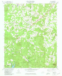
1980 Map of Handy
USGS Topo · Published 1980About this map
The Uwharrie National Forest anchors the southern half of this landscape, where the confluence of several waterways defines the Davidson and Randolph county borderlands. The terrain is marked by a network of drainage systems including Cabin Creek, Laniers Creek, and the South Fork of Second Creek, which flow toward the southern reaches of Badin Lake. The map reveals a dispersed settlement pattern centered around small rural hubs like Handy, New Hope, and Loflin, many of which grew around family names and country churches.
Find a feature on this map
60 named features on this map. Tap any name to fly to it.
Don’t see what you’re looking for? This feature index may not catch every label — zoom into the map to look around manually.
Map Details
Editions of this 1980 Handy Map
This is the sole edition of this map. No revisions or reprints were ever made.
Other maps of this area

1942 · Troy
USGS Topo · 1:125,000

1949 · High Rock
USGS Topo · 1:24,000

1949 · Denton NW
USGS Topo · 1:24,000

1953 · Raleigh
USGS Topo · 1:250,000

1953 · Charlotte
USGS Topo · 1:250,000

1954 · Charlotte
USGS Topo · 1:250,000

1954 · Raleigh
USGS Topo · 1:250,000

1957 · Albemarle
USGS Topo · 1:62,500

1957 · Denton
USGS Topo · 1:62,500

1957 · Troy
USGS Topo · 1:62,500