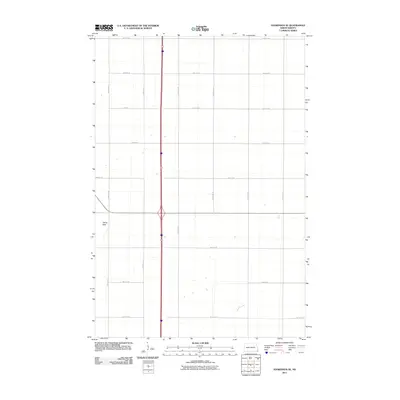
2011 Map of Hankinson SE
USGS Topo · Published 2011About this map
Devils Nest anchors the western portion of this Richland County landscape, a terrain feature that stands out within the precise grid of the Red River Valley’s agricultural section lines. The map captures a transition in rural infrastructure where major local arteries like County Rd 1 and County Rd 15 intersect a dense network of numbered townships roads. This 2011 survey, produced by the U.S. Geological Survey, reflects the persistent geometry of North Dakota's farming country, organized by routes such as 169th Ave SE and 97th St SE. The sparse distribution of named features underscores the vastness of the prairie environment, where the land is defined by its surveying intervals and the critical drainage and transportation corridors that support the region's agricultural economy.
Find a feature on this map
17 named features on this map. Tap any name to fly to it.
Don’t see what you’re looking for? This feature index may not catch every label — zoom into the map to look around manually.
Map Details
Editions of this 2011 Hankinson SE Map
This is the sole edition of this map. No revisions or reprints were ever made.
Other maps of this area

1904 · Wahpeton
USGS Topo · 1:125,000

1915 · White Rock
USGS Topo · 1:62,500

1917 · New Effington
USGS Topo · 1:62,500

1918 · White Rock
USGS Topo · 1:62,500

1953 · Milbank
USGS Topo · 1:250,000

1953 · Fargo
USGS Topo · 1:250,000

1956 · Fargo
USGS Topo · 1:250,000

1958 · Milbank
USGS Topo · 1:250,000

1964 · Hankinson
USGS Topo · 1:24,000

1964 · Fairmount NW
USGS Topo · 1:24,000