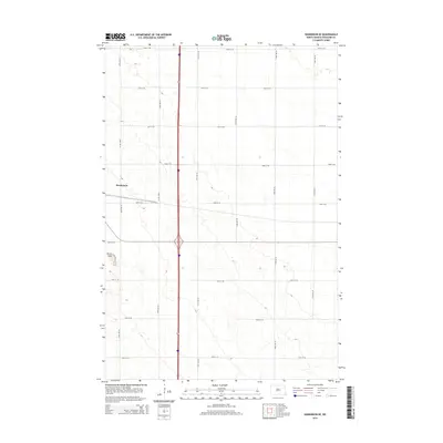
2014 Map of Hankinson SE
USGS Topo · Published 2014About this map
The prairie landscape south of Hankinson is defined by a rigorous section-line road grid and the subtle topographic shift of the Devils Nest terrain feature. This 2014 survey captures the rural character of Richland County, where a network of thoroughfares such as 169th Ave SE and 174th Ave SE crisscross the fertile plains. The intersection of these county roads and the east-west corridors like 93rd St SE reveal the enduring influence of the Public Land Survey System on the development and accessibility of North Dakota's agricultural heartland. Small pockets of varying elevation and natural depressions contrast with the straight-line geometry of the transportation network, providing a clear record of the region's modern land use and infrastructure.
Find a feature on this map
17 named features on this map. Tap any name to fly to it.
Don’t see what you’re looking for? This feature index may not catch every label — zoom into the map to look around manually.
Map Details
Editions of this 2014 Hankinson SE Map
This is the sole edition of this map. No revisions or reprints were ever made.
Other maps of this area

1904 · Wahpeton
USGS Topo · 1:125,000

1915 · White Rock
USGS Topo · 1:62,500

1917 · New Effington
USGS Topo · 1:62,500

1918 · White Rock
USGS Topo · 1:62,500

1953 · Milbank
USGS Topo · 1:250,000

1953 · Fargo
USGS Topo · 1:250,000

1956 · Fargo
USGS Topo · 1:250,000

1958 · Milbank
USGS Topo · 1:250,000

1964 · Hankinson
USGS Topo · 1:24,000

1964 · Fairmount NW
USGS Topo · 1:24,000