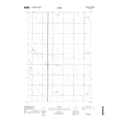
2017 Map of Hankinson SE
USGS Topo · Published 2017About this map
Hankinson anchors the western edge of this Richland County landscape, where the flat agricultural plains of southeast North Dakota are interrupted by the distinct topography of Devils Nest. This 2017 study illustrates a strictly gridded rural environment, defined by an expansive network of sectional roads such as 171st Ave SE and 93rd St SE. The map provides a contemporary view of the region's land management, showing the precise division of townships including t130n r49w and t131n r48w. While much of the terrain is dedicated to large-scale farming, the irregular contours and wetlands near the Devils Nest landmark offer a sharp contrast to the surrounding rectilinear fields. This document is particularly useful for observing how modern infrastructure, such as Co Rd 15, overlays the historical Public Land Survey System grid that has shaped the Dakotas for over a century.
Find a feature on this map
26 named features on this map. Tap any name to fly to it.
Don’t see what you’re looking for? This feature index may not catch every label — zoom into the map to look around manually.
Map Details
Editions of this 2017 Hankinson SE Map
This is the sole edition of this map. No revisions or reprints were ever made.
Other maps of this area

1904 · Wahpeton
USGS Topo · 1:125,000

1915 · White Rock
USGS Topo · 1:62,500

1917 · New Effington
USGS Topo · 1:62,500

1918 · White Rock
USGS Topo · 1:62,500

1953 · Milbank
USGS Topo · 1:250,000

1953 · Fargo
USGS Topo · 1:250,000

1956 · Fargo
USGS Topo · 1:250,000

1958 · Milbank
USGS Topo · 1:250,000

1964 · Hankinson
USGS Topo · 1:24,000

1964 · Fairmount NW
USGS Topo · 1:24,000