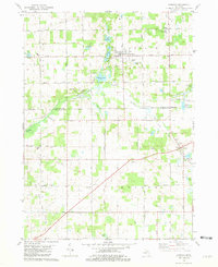
1981 Map of Hanover
USGS Topo · Published 1981About this map
Hanover and Moscow serve as the primary hubs in this late-twentieth-century study of the boundary between Jackson and Hillsdale Counties. The landscape is defined by the winding course of the South Branch Kalamazoo River, which connects a series of glacial water bodies including Bibbons Lake and Horseshoe Lake. The transition from a rail-dependent economy to one of utility and extraction is evident in the presence of an Old Railroad Grade alongside active infrastructure like a regional Pipeline and a sprawling Gas Field in the southwest corner near Milnes. Local history is well-preserved through numerous family and community landmarks, such as the McNair Cem, Blackmar Cem, and the Moscow Plains Ch. This period shows the consolidation of rural education at the Hanover-Horton High Sch, while the survival of small nodes like Mosherville Station recalls the area's earlier transportation network.
Find a feature on this map
50 named features on this map. Tap any name to fly to it.
Don’t see what you’re looking for? This feature index may not catch every label — zoom into the map to look around manually.
Map Details
Editions of this 1981 Hanover Map
This is the sole edition of this map. No revisions or reprints were ever made.
Other maps of this area

1935 · Jackson
USGS Topo · 1:48,000

1939 · Jackson
USGS Topo · 1:62,500

1948 · Spring Arbor
USGS Topo · 1:62,500

1949 · Spring Arbor
USGS Topo · 1:62,500

1953 · Fort Wayne
USGS Topo · 1:250,000

1956 · Fort Wayne
USGS Topo · 1:250,000

1958 · Grand Rapids
USGS Topo · 1:250,000

1959 · Hillsdale
USGS Topo · 1:24,000

1959 · North Adams
USGS Topo · 1:24,000

1961 · Grand Rapids
USGS Topo · 1:250,000