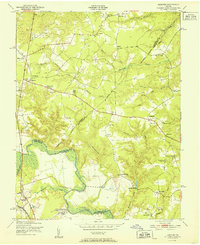
1951 Map of Hanover
USGS Topo · Published 1951About this map
The Pamunkey River winds along the tri-county border of Caroline, King William, and Hanover, anchoring a landscape of agricultural and institutional history. Near the river's southern bend, the Virginia Industrial School for Boys occupies a large tract of land, while the nearby State Convict Camp and local courthouse at Hanover suggest the area's administrative and correctional functions during the early 1950s. The road network connects a series of small, dispersed settlements such as Mangohick, Etna Mills, and Haleys Corner, many of which grew around rural crossroads, general stores, or local industry.
Find a feature on this map
49 named features on this map. Tap any name to fly to it.
Don’t see what you’re looking for? This feature index may not catch every label — zoom into the map to look around manually.
Map Details
Editions of this 1951 Hanover Map
This is the sole edition of this map. No revisions or reprints were ever made.
Other maps of this area

1894 · Richmond
USGS Topo · 1:62,500

1895 · Richmond
USGS Topo · 1:62,500

1918 · Doswell
USGS Topo · 1:62,500

1918 · Aylett
USGS Topo · 1:62,500

1920 · King William
USGS Topo · 1:62,500

1933 · Aylett
USGS Topo · 1:62,500

1938 · Studley
USGS Topo · 1:31,680

1938 · Yellow Tavern
USGS Topo · 1:31,680

1943 · Richmond
USGS Topo · 1:250,000

1949 · Richmond
USGS Topo · 1:250,000