
1895 Map of Richmond
USGS Topo · Published 1895About this map
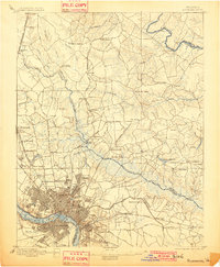
Richmond and Manchester sit at the fall line of the James River during the late nineteenth century, serving as the industrial and transportation hub for central Virginia. The city’s dense street grid terminates at the City Line, beyond which the landscape quickly transitions into a network of historic turnpikes and rural settlements. To the northeast, the Chickahominy River creates a broad, swampy barrier crossed by critical spans like Meadow Bridge and Grapevine Bridge. This era of the landscape is defined by its proximity to the American Civil War, marked by the presence of a National Cemetery and the still-evident positions at Old Cold Harbor and Seven Pines. Numerous milling operations, such as Branche Mill and Barker Mill Pond, are scattered along the creeks, while the Chesapeake and Ohio Railroad and the Richmond Fredericksburg and Potomac R.R. anchor the region's northern development.
Find a feature on this map
95 named features on this map. Tap any name to fly to it.
Don’t see what you’re looking for? This feature index may not catch every label — zoom into the map to look around manually.
Map Details
Editions of this 1895 Richmond Map
5 editions found
Other maps of this area

1890 · Goochland
USGS Topo · 1:125,000

1892 · Goochland
USGS Topo · 1:125,000

1894 · Bermuda Hundred
USGS Topo · 1:62,500

1894 · Richmond
USGS Topo · 1:62,500

1897 · Amelia
USGS Topo · 1:125,000

1918 · Charles City
USGS Topo · 1:62,500

1918 · Doswell
USGS Topo · 1:62,500

1918 · Aylett
USGS Topo · 1:62,500

1920 · King William
USGS Topo · 1:62,500

1933 · Aylett
USGS Topo · 1:62,500