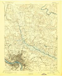
1895 Map of Richmond
USGS Topo · Published 1920About this map
Richmond and its northern surroundings appear here as surveyed in the late 19th century, showing a landscape still heavily defined by the fortifications and sites of recent conflict. The Chickahominy River marshlands form a wide natural barrier between the city and the northern settlements like Mechanicsville, crossed only by critical infrastructure such as the Meadow Bridge and New Bridge. The map captures the transition from urban density to the rural county seats, with many locations such as Old Cold Harbor, Seven Pines, and Gaines Mill Pond marking the ground of major Civil War engagements just decades prior.
Find a feature on this map
81 named features on this map. Tap any name to fly to it.
Don’t see what you’re looking for? This feature index may not catch every label — zoom into the map to look around manually.
Map Details
Editions of this 1895 Richmond Map
5 editions found
Other maps of this area

1890 · Goochland
USGS Topo · 1:125,000

1892 · Goochland
USGS Topo · 1:125,000

1894 · Bermuda Hundred
USGS Topo · 1:62,500

1894 · Richmond
USGS Topo · 1:62,500

1895 · Richmond
USGS Topo · 1:62,500

1897 · Amelia
USGS Topo · 1:125,000

1918 · Charles City
USGS Topo · 1:62,500

1918 · Doswell
USGS Topo · 1:62,500

1918 · Aylett
USGS Topo · 1:62,500

1920 · King William
USGS Topo · 1:62,500