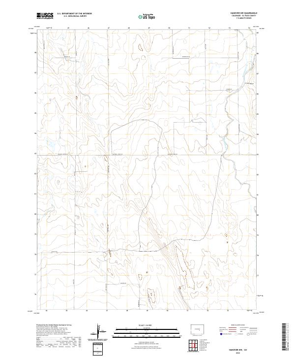
2022 Map of Hanover NW
USGS Topo · Published 2022About this map
Crows Roost overlooks an arid landscape of eastern El Paso County, where the high plains terrain is defined by north-south drainages and a rigid grid of section lines. The drainage of Black Squirrel Creek cuts through the northeast corner of the quadrangle, while Chico Creek meanders through the southwest, illustrating the subtle hydrology of this semi-arid region.
Find a feature on this map
24 named features on this map. Tap any name to fly to it.
Don’t see what you’re looking for? This feature index may not catch every label — zoom into the map to look around manually.
Map Details
Editions of this 2022 Hanover NW Map
This is the sole edition of this map. No revisions or reprints were ever made.
Other maps of this area

1893 · Big Springs
USGS Topo · 1:125,000

1893 · Colorado Springs
USGS Topo · 1:125,000

1909 · Colorado Springs
USGS Topo · 1:125,000

1942 · Colorado Springs
USGS Topo · 1:125,000

1948 · Fountain SE
USGS Topo · 1:24,000

1948 · Falcon
USGS Topo · 1:62,500

1949 · Corral Bluffs
USGS Topo · 1:24,000
1950 · Fountain NE
USGS Topo · 1:24,000
1950 · Fountain SE
USGS Topo · 1:24,000
1951 · Falcon
USGS Topo · 1:62,500