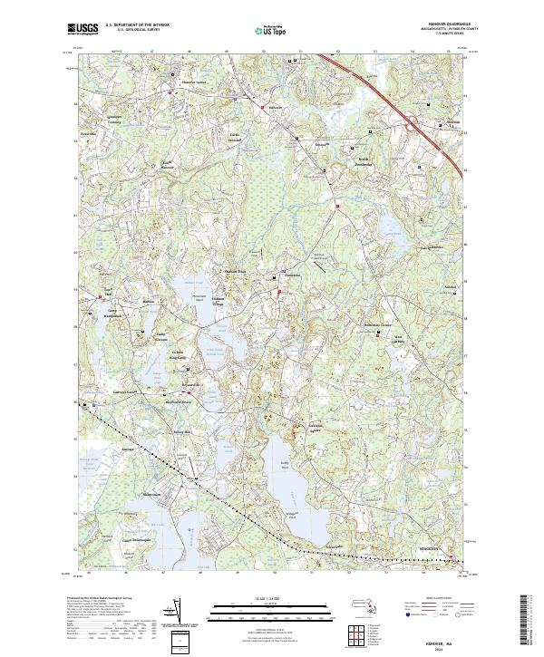
2024 Map of Hanover
USGS Topo · Published 2024About this map
Hanover and Pembroke sit at the center of this detailed coastal plain survey, where the Indian Head River and North River define the local topography. The landscape is a complex network of glacial ponds and wetlands, including Oldham Pond, Furnace Pond, and the Little Cedar Swamp. These water bodies historically drove local industry and settlement patterns, evidenced by the cluster of small villages like Oldham Village and Winslows Crossing. Genealogists will find a high density of burial sites, from the Friends Burying Ground Cem to the Briggs Burying Ground Cem, reflecting the deep colonial and Quaker roots of Plymouth County. The area’s recreational and aviation history is also prominent, featuring numerous summer camps such as Camp Wampatuck and Camp Ousamequin, alongside the Cranland Airport and the Sherman-Privat Airport, illustrating the transition from a water-and-rail economy to modern residential and leisure use.
Find a feature on this map
168 named features on this map. Tap any name to fly to it.
Don’t see what you’re looking for? This feature index may not catch every label — zoom into the map to look around manually.
Map Details
Editions of this 2024 Hanover Map
This is the sole edition of this map. No revisions or reprints were ever made.
Other maps of this area

1885 · Abington
USGS Topo · 1:62,500

1885 · Duxbury
USGS Topo · 1:62,500

1885 · Middleboro
USGS Topo · 1:62,500

1886 · Plymouth
USGS Topo · 1:62,500

1888 · Duxbury
USGS Topo · 1:62,500

1888 · Middleboro
USGS Topo · 1:62,500

1888 · Abington
USGS Topo · 1:62,500

1889 · Plymouth
USGS Topo · 1:62,500

1893 · Abington
USGS Topo · 1:62,500

1893 · Duxbury
USGS Topo · 1:62,500