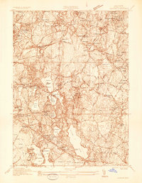
1935 Map of Hanover
USGS Topo · Published 1935About this map
Silver Lake and a dense network of kettle ponds dominate this 1935 survey of northern Plymouth County, reflecting a landscape defined by glacial geology and early industrial development. Large-scale manufacturing is evident at National Fireworks Inc and the Wheeler Reflector Plant, while the social fabric of the era is anchored by landmarks like the Friends Meeting House and Hanson Town Hall.
Find a feature on this map
76 named features on this map. Tap any name to fly to it.
Don’t see what you’re looking for? This feature index may not catch every label — zoom into the map to look around manually.
Map Details
Editions of this 1935 Hanover Map
This is the sole edition of this map. No revisions or reprints were ever made.
Other maps of this area

1885 · Abington
USGS Topo · 1:62,500

1885 · Duxbury
USGS Topo · 1:62,500

1885 · Middleboro
USGS Topo · 1:62,500

1886 · Plymouth
USGS Topo · 1:62,500

1888 · Duxbury
USGS Topo · 1:62,500

1888 · Middleboro
USGS Topo · 1:62,500

1888 · Abington
USGS Topo · 1:62,500

1889 · Plymouth
USGS Topo · 1:62,500

1893 · Abington
USGS Topo · 1:62,500

1893 · Duxbury
USGS Topo · 1:62,500