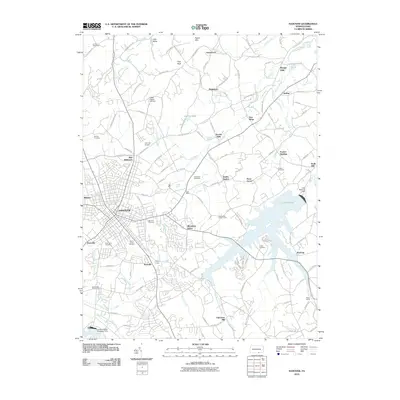
2010 Map of Hanover
USGS Topo · Published 2010About this map
Lake Marburg and the sprawling Codorus State Park dominate the southeastern landscape of this York County region, illustrating how massive water management projects reshaped the local topography. Further north, the agricultural and industrial roots of the area remain visible through historic mill sites like Menges Mills, Jacobs Mills, and Kraft Mill, which sit along the winding courses of Oil Creek and Codorus Creek. The city of Hanover serves as the primary hub, surrounded by a ring of smaller communities including Pennville, Parkville, and Blooming Grove.
Find a feature on this map
123 named features on this map. Tap any name to fly to it.
Don’t see what you’re looking for? This feature index may not catch every label — zoom into the map to look around manually.
Map Details
Editions of this 2010 Hanover Map
This is the sole edition of this map. No revisions or reprints were ever made.
Other maps of this area

1905 · Westminster
USGS Topo · 1:62,500

1908 · Gettysburg
USGS Topo · 1:62,500

1911 · Taneytown
USGS Topo · 1:62,500

1920 · Hanover
USGS Topo · 1:62,500

1922 · Hanover
USGS Topo · 1:62,500

1942 · Gettysburg
USGS Topo · 1:125,000

1944 · Manchester
USGS Topo · 1:31,680

1944 · Mc Sherrystown
USGS Topo · 1:31,680

1944 · Littlestown
USGS Topo · 1:31,680

1944 · Lineboro
USGS Topo · 1:31,680