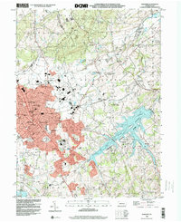
1998 Map of Hanover
USGS Topo · Published 2000About this map
Hanover serves as the dense urban anchor of this late 1990s survey, surrounded by a complex network of rural hamlets and water-driven history. The landscape transitions from the industrial activity at Kraft Mill and the aviation hub of Devener Airport to the expansive waters of Marburg Lake. This reservoir, contained within Codorus State Park, dramatically reshaped the local geography of Penn and Manheim townships. Evidence of the region’s milling heritage remains visible through sites like Menges Mills and Fuhrmans Mill, located along the winding courses of Menges Mills Creek and West Branch Codorus Creek. To the north, the terrain rises toward High Rock and Iron Ridge, while the CSX railroad corridor traces the historic path of commerce through Porters Sideling and Ambau. Numerous small educational and religious institutions, such as Staffers Sch and Wildasin Chapel, are scattered throughout the countryside, marking the established social fabric of York County's borderlands.
Find a feature on this map
78 named features on this map. Tap any name to fly to it.
Don’t see what you’re looking for? This feature index may not catch every label — zoom into the map to look around manually.
Map Details
Editions of this 1998 Hanover Map
This is the sole edition of this map. No revisions or reprints were ever made.
Other maps of this area

1905 · Westminster
USGS Topo · 1:62,500

1908 · Gettysburg
USGS Topo · 1:62,500

1911 · Taneytown
USGS Topo · 1:62,500

1920 · Hanover
USGS Topo · 1:62,500

1922 · Hanover
USGS Topo · 1:62,500

1942 · Gettysburg
USGS Topo · 1:125,000

1944 · Manchester
USGS Topo · 1:31,680

1944 · Mc Sherrystown
USGS Topo · 1:31,680

1944 · Littlestown
USGS Topo · 1:31,680

1944 · Lineboro
USGS Topo · 1:31,680