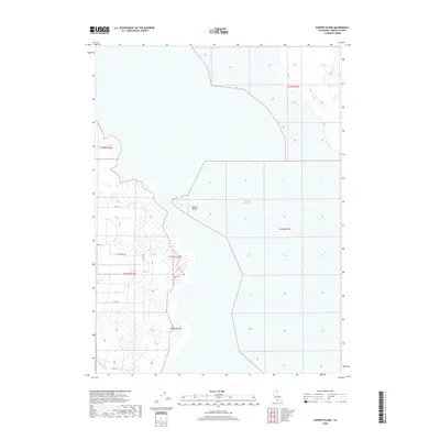
2018 Map of Hansen Island
USGS Topo · Published 2018About this map
Middle Alkali Lake dominates this portion of the Surprise Valley, revealing a landscape defined by the seasonal ebbs and flows of a high-desert basin. The eastern shore of the lakebed is fed by watercourses like Bull Cr, while the western edge transitions into land marked by early township boundaries. Hansen Island stands out as a distinct landform within the lake's footprint, appearing here alongside the Outlet to the south. Local transit is managed by a network of rural routes, including Co Rd 30 and Patterson Ln, which provide access to the agricultural and grazing tracts bordering Cottonwood Cr. This survey illustrates the relationship between the arid alkali flats and the persistent water sources that supported settlement in Modoc County during the early 21st century.
Find a feature on this map
14 named features on this map. Tap any name to fly to it.
Don’t see what you’re looking for? This feature index may not catch every label — zoom into the map to look around manually.
Map Details
Editions of this 2018 Hansen Island Map
This is the sole edition of this map. No revisions or reprints were ever made.
Other maps of this area

1886 · Alturas
USGS Topo · 1:250,000

1889 · Long Valley
USGS Topo · 1:250,000

1892 · Alturas
USGS Topo · 1:250,000

1954 · Vya
USGS Topo · 1:250,000

1954 · Alturas
USGS Topo · 1:250,000

1958 · Alturas
USGS Topo · 1:250,000

1958 · Vya
USGS Topo · 1:250,000

1962 · Alturas
USGS Topo · 1:250,000

1962 · Vya
USGS Topo · 1:250,000

1962 · Cedarville
USGS Topo · 1:62,500