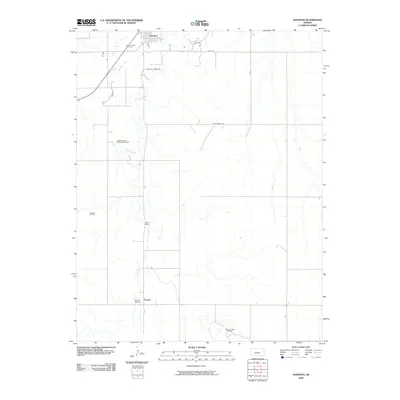
2009 Map of Hanston
USGS Topo · Published 2009About this map
Hanston and the small settlement of Orwell anchor this West-Central Kansas landscape, where the agricultural plains meet a network of energy extraction. The map reveals a region defined by its watercourses, with Buckner Creek and Saw-Log Creek cutting through the terrain. These natural features are matched by human engineering, visible in the Osborne Bridge and Orwell Bridge. Outside the town centers, the land is heavily marked by the petroleum industry, featuring the Hanston-Oppy Southeast Oil Field, Lippoldt Oil Field, and Saw Log Creek Oil Field. This survey provides a look at the rural infrastructure supporting these industries, from Saint Anthony Cemetery to the local road network including Ruff Rd and Old Oil Lease Rd.
Find a feature on this map
14 named features on this map. Tap any name to fly to it.
Don’t see what you’re looking for? This feature index may not catch every label — zoom into the map to look around manually.
Map Details
Editions of this 2009 Hanston Map
This is the sole edition of this map. No revisions or reprints were ever made.
Other maps of this area

1892 · Ness
USGS Topo · 1:125,000

1892 · Spearville
USGS Topo · 1:125,000

1894 · Spearville
USGS Topo · 1:125,000

1894 · Ness
USGS Topo · 1:125,000

1955 · Great Bend
USGS Topo · 1:250,000

1955 · Pratt
USGS Topo · 1:250,000

1957 · Great Bend
USGS Topo · 1:250,000

1958 · Great Bend
USGS Topo · 1:250,000

1959 · Pratt
USGS Topo · 1:250,000

1970 · Jetmore SE
USGS Topo · 1:24,000