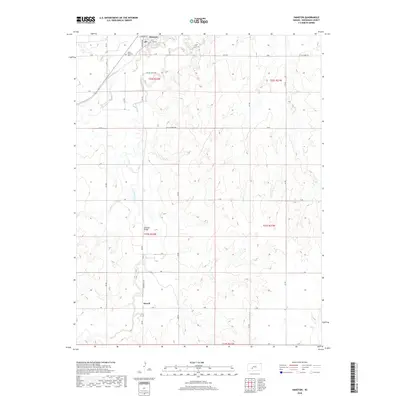
2018 Map of Hanston
USGS Topo · Published 2018About this map
Hanston anchors this part of Hodgeman County, situated along the banks of Buckner Cr. The settlement’s grid is clearly defined by streets like Main St and Highway Ave, representing a classic High Plains agricultural hub. Further south, the landscape is marked by the course of Saw Log Cr, which winds through a terrain defined by sections and townships. Significant cultural markers include the Saint Anthony Cem and the Osborne Bridge, providing clear reference points for genealogists tracing family ties to this region. The presence of Old Oil Lease Rd suggests the historical importance of energy extraction in this part of Kansas, while the smaller locality of Orwell appears to the south along Spearville Rd.
Find a feature on this map
28 named features on this map. Tap any name to fly to it.
Don’t see what you’re looking for? This feature index may not catch every label — zoom into the map to look around manually.
Map Details
Editions of this 2018 Hanston Map
This is the sole edition of this map. No revisions or reprints were ever made.
Other maps of this area

1892 · Ness
USGS Topo · 1:125,000

1892 · Spearville
USGS Topo · 1:125,000

1894 · Spearville
USGS Topo · 1:125,000

1894 · Ness
USGS Topo · 1:125,000

1955 · Great Bend
USGS Topo · 1:250,000

1955 · Pratt
USGS Topo · 1:250,000

1957 · Great Bend
USGS Topo · 1:250,000

1958 · Great Bend
USGS Topo · 1:250,000

1959 · Pratt
USGS Topo · 1:250,000

1970 · Jetmore SE
USGS Topo · 1:24,000