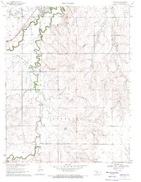
1970 Map of Hanston
USGS Topo · Published 1971About this map
Hanston sits at the northern edge of this Kansas landscape, where the Atchison Topeka and Santa Fe railroad tracks cut across the plains near the winding course of Buckner Creek. This 1970 snapshot of Hodgeman County reveals a region defined by its agricultural grid and the development of energy resources, with numerous wells scattered throughout the Marena Field and Sterling Field. The interplay between the natural meandering of waterways and the rigid section lines of the public land survey system is clearly visible here.
Find a feature on this map
18 named features on this map. Tap any name to fly to it.
Don’t see what you’re looking for? This feature index may not catch every label — zoom into the map to look around manually.
Map Details
Editions of this 1970 Hanston Map
This is the sole edition of this map. No revisions or reprints were ever made.
Other maps of this area

1892 · Ness
USGS Topo · 1:125,000

1892 · Spearville
USGS Topo · 1:125,000

1894 · Spearville
USGS Topo · 1:125,000

1894 · Ness
USGS Topo · 1:125,000

1955 · Great Bend
USGS Topo · 1:250,000

1955 · Pratt
USGS Topo · 1:250,000

1957 · Great Bend
USGS Topo · 1:250,000

1958 · Great Bend
USGS Topo · 1:250,000

1959 · Pratt
USGS Topo · 1:250,000

1970 · Jetmore SE
USGS Topo · 1:24,000