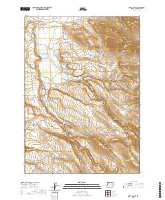
2020 Map of Happy Valley
USGS Topo · Published 2020About this map
Happy Valley is situated in a high desert landscape characterized by the winding path of Riddle Cr, which drains toward the southeast across this portion of Harney County. The area reflects the classic settlement patterns of eastern Oregon, where small agricultural hubs formed in fertile basins surrounded by the rising elevations of the Great Basin. This 2020 edition provides a contemporary look at the rural infrastructure of the valley, documenting the persistent road networks and hydraulic features that have sustained ranching and local life in this isolated interior for generations.
Find a feature on this map
2 named features on this map. Tap any name to fly to it.
Don’t see what you’re looking for? This feature index may not catch every label — zoom into the map to look around manually.
Map Details
Editions of this 2020 Happy Valley Map
This is the sole edition of this map. No revisions or reprints were ever made.
Other maps of this area

1955 · Burns
USGS Topo · 1:250,000

1955 · Adel
USGS Topo · 1:250,000

1957 · Adel
USGS Topo · 1:250,000

1958 · Burns
USGS Topo · 1:250,000

1958 · Adel
USGS Topo · 1:250,000

1959 · Burns
USGS Topo · 1:250,000

1962 · Adel
USGS Topo · 1:250,000

1967 · Happy Valley
USGS Topo · 1:24,000

1967 · Barton Lake
USGS Topo · 1:24,000

1967 · Diamond
USGS Topo · 1:24,000