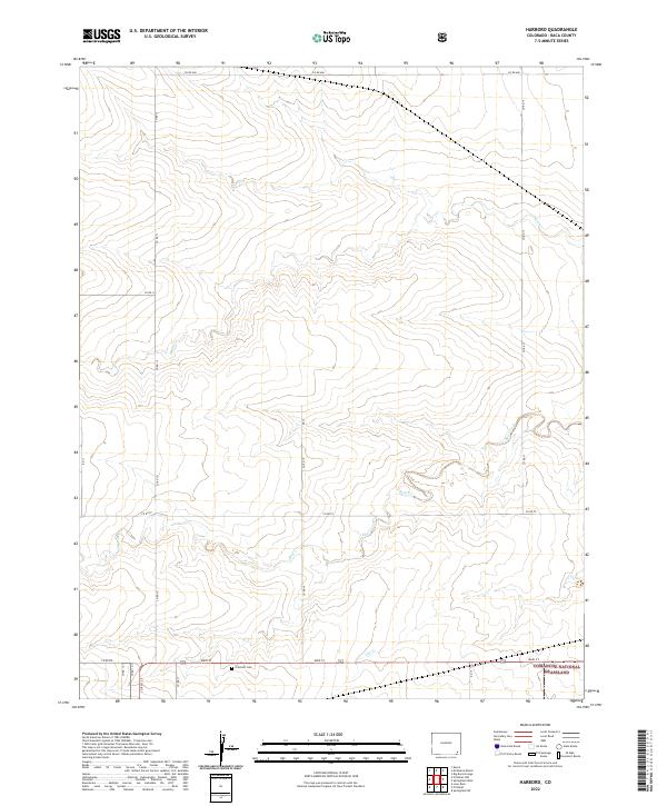
2022 Map of Harbord
USGS Topo · Published 2022About this map
Comanche National Grassland encompasses the southeastern corner of this Baca County landscape, reflecting the modern conservation status of the High Plains. The terrain is defined by a series of intermittent watercourses that drain the surrounding prairie, including the winding paths of Plum Cr, Bear Creek, and Cat Cr. A structured grid of county roads, such as Co RD MM and Co RD 17, facilitates travel across the township and range lines. For those researching local history or genealogy, the Pritchett Cem stands as a notable landmark near the southern boundary, situated just north of Main St. The map illustrates a contemporary view of this rural agricultural and grassland region, where the intersection of natural drainage patterns and human-imposed road systems remains the primary organizing principle of the landscape.
Find a feature on this map
26 named features on this map. Tap any name to fly to it.
Don’t see what you’re looking for? This feature index may not catch every label — zoom into the map to look around manually.
Map Details
Editions of this 2022 Harbord Map
This is the sole edition of this map. No revisions or reprints were ever made.
Other maps of this area

1891 · Springfield
USGS Topo · 1:125,000

1892 · Two Butte
USGS Topo · 1:125,000

1893 · Two Butte
USGS Topo · 1:125,000

1893 · Springfield
USGS Topo · 1:125,000

1955 · La Junta
USGS Topo · 1:250,000

1958 · La Junta
USGS Topo · 1:250,000

1968 · La Junta
USGS Topo · 1:250,000
1971 · Big Rock Grange
USGS Topo · 1:24,000
1971 · Mc Endree Ranch
USGS Topo · 1:24,000
1971 · Deora
USGS Topo · 1:24,000