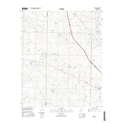
2017 Map of Hardin
USGS Topo · Published 2017About this map
The Grant and Jefferson County line divides a landscape defined by the branching tributaries of the Arkansas River system. The small community of Hardin sits at a geographic crossroads in the southeast, near the emerging suburban development of Oakland Heights. Northward, the terrain is shaped by the winding paths of Derrieusseaux Creek and its many forks, which provide a natural drainage network for the timberlands and small settlements like Midway and Doylestown.
Find a feature on this map
131 named features on this map. Tap any name to fly to it.
Don’t see what you’re looking for? This feature index may not catch every label — zoom into the map to look around manually.
Map Details
Editions of this 2017 Hardin Map
This is the sole edition of this map. No revisions or reprints were ever made.
Other maps of this area

1932 · Pastoria
USGS Topo · 1:62,500

1935 · Pastoria
USGS Topo · 1:62,500

1955 · Little Rock
USGS Topo · 1:250,000

1956 · Little Rock
USGS Topo · 1:250,000

1960 · Little Rock
USGS Topo · 1:250,000

1962 · Pine Bluff
USGS Topo · 1:24,000

1962 · Pine Bluff NW
USGS Topo · 1:24,000

1964 · Little Rock
USGS Topo · 1:250,000

1964 · Cane Creek
USGS Topo · 1:24,000
1964 · Prague
USGS Topo · 1:24,000