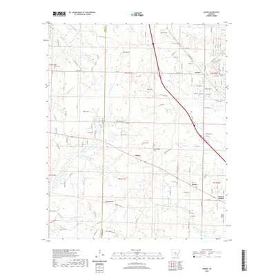
2020 Map of Hardin
USGS Topo · Published 2020About this map
Hardin and Doylestown anchor this rural landscape in Jefferson and Grant counties, where the terrain is defined by a dense network of tributaries including Bayou Bartholomew and Little Derrieusseaux Cr. The area is characterized by scattered small settlements such as Midway and Samples, linked by a web of local roads like Keg Mill Rd and Dogwood Dr. In the northeast, the presence of the Pine Bluff Arsenal and the Thi Landfill indicate specialized land use alongside residential growth in Oakland Heights. For genealogists and local historians, the sheet preserves the locations of numerous small burial grounds, including Hardin Cem, Old Shiloh Cem, and Morris Cem. High ground is marked by named features like Gum Springs Hill and Sanders Hill, providing a clear view of the drainage patterns shaping this part of Arkansas.
Find a feature on this map
131 named features on this map. Tap any name to fly to it.
Don’t see what you’re looking for? This feature index may not catch every label — zoom into the map to look around manually.
Map Details
Editions of this 2020 Hardin Map
This is the sole edition of this map. No revisions or reprints were ever made.
Other maps of this area

1932 · Pastoria
USGS Topo · 1:62,500

1935 · Pastoria
USGS Topo · 1:62,500

1955 · Little Rock
USGS Topo · 1:250,000

1956 · Little Rock
USGS Topo · 1:250,000

1960 · Little Rock
USGS Topo · 1:250,000

1962 · Pine Bluff
USGS Topo · 1:24,000

1962 · Pine Bluff NW
USGS Topo · 1:24,000

1964 · Little Rock
USGS Topo · 1:250,000

1964 · Cane Creek
USGS Topo · 1:24,000
1964 · Prague
USGS Topo · 1:24,000