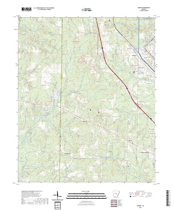
2024 Map of Hardin
USGS Topo · Published 2024About this map
The Grant and Jefferson County line divides this landscape of winding creek systems and scattered settlements. The central community of Hardin serves as a focal point near the Hardin Cemetery, while smaller rural clusters like Midway, Doylestown, and Samples mark the intersections of local roads. In the northeast corner, the edge of the Pine Bluff Arsenal contrasts with the surrounding timberlands and agricultural plots.
Find a feature on this map
129 named features on this map. Tap any name to fly to it.
Don’t see what you’re looking for? This feature index may not catch every label — zoom into the map to look around manually.
Map Details
Editions of this 2024 Hardin Map
This is the sole edition of this map. No revisions or reprints were ever made.
Other maps of this area

1932 · Pastoria
USGS Topo · 1:62,500

1935 · Pastoria
USGS Topo · 1:62,500

1955 · Little Rock
USGS Topo · 1:250,000

1956 · Little Rock
USGS Topo · 1:250,000

1960 · Little Rock
USGS Topo · 1:250,000

1962 · Pine Bluff
USGS Topo · 1:24,000

1962 · Pine Bluff NW
USGS Topo · 1:24,000

1964 · Little Rock
USGS Topo · 1:250,000

1964 · Cane Creek
USGS Topo · 1:24,000
1964 · Prague
USGS Topo · 1:24,000