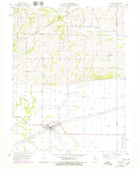
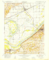
1957 Map of Hardin
USGS Topo · Published 1979About this map
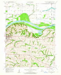
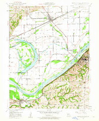
Hardin occupies a central role in this landscape where the Crooked River meanders across the floodplain of the Missouri River valley. The town's layout is defined by the intersection of local roads and the Atchison Topeka and Santa Fe and Wabash railroad, which runs parallel to a series of engineering features including a levee and a Drainage Ditch. The transition from the flat bottomlands to the northern uplands is marked by geographic features like Grape Grove and Prairie, showing a shift from managed riverfront to more traditional agricultural terrain.
Find a feature on this map
23 named features on this map. Tap any name to fly to it.
Don’t see what you’re looking for? This feature index may not catch every label — zoom into the map to look around manually.
Map Details
Editions of this 1957 Hardin Map
2 editions found
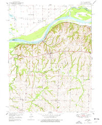
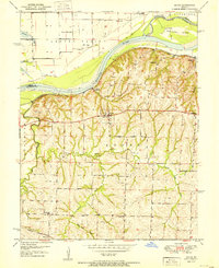
Other maps of this area

1889 · Lexington
USGS Topo · 1:125,000
1949 · Lexington East
USGS Topo · 1:24,000
1949 · Lexington West
USGS Topo · 1:24,000

1950 · Lexington East
USGS Topo · 1:24,000
1950 · Lexington West
USGS Topo · 1:24,000
1950 · Dover
USGS Topo · 1:24,000
1951 · Dover
USGS Topo · 1:24,000

1953 · Moberly
USGS Topo · 1:250,000

1954 · Moberly
USGS Topo · 1:250,000

1957 · Moberly
USGS Topo · 1:250,000