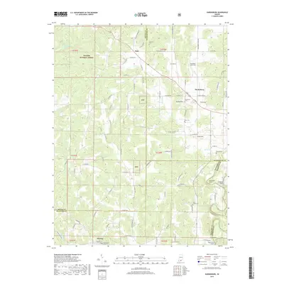
2019 Map of Hardinsburg
USGS Topo · Published 2019About this map
Hardinsburg and Marengo anchor this map of the karst-heavy landscape spanning Orange, Washington, and Crawford Counties. The terrain is defined by unique subterranean drainage features like Scotland Cave Sink, Posey Sink, and Honey Sink, which illustrate the region's complex geological structure. Portions of the Hoosier National Forest cover the western uplands, where small settlements like Rego are connected by rural routes such as the Valeene Pike. Genealogists will find several burial sites including the Marengo Cem Old Section and Walton Cem. In the southeast, the winding Blue River and Whiskey Run drain toward the Totten Ford Bridge, a key crossing point near the Harrison County line. The map captures a landscape where traditional ridge-top roads like W Pavey Ridge Rd follow the topography, avoiding the deep sinkholes and complex creek systems like Sinking Cr and Cedar Fork.
Find a feature on this map
102 named features on this map. Tap any name to fly to it.
Don’t see what you’re looking for? This feature index may not catch every label — zoom into the map to look around manually.
Map Details
Editions of this 2019 Hardinsburg Map
This is the sole edition of this map. No revisions or reprints were ever made.
Other maps of this area

1946 · Depauw
USGS Topo · 1:24,000

1947 · Hardinsburg
USGS Topo · 1:24,000

1948 · Milltown
USGS Topo · 1:24,000

1949 · Hardinsburg
USGS Topo · 1:24,000

1950 · Becks Mill
USGS Topo · 1:24,000

1950 · Valeene
USGS Topo · 1:24,000

1950 · English
USGS Topo · 1:24,000

1953 · Fredericksburg
USGS Topo · 1:24,000

1956 · Vincennes
USGS Topo · 1:250,000

1957 · Vincennes
USGS Topo · 1:250,000