
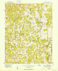
1949 Map of Hardinsburg
USGS Topo · Published 1949About this map
The boundary of Orange, Washington, Crawford, and Harrison counties converges in this landscape defined by the winding course of the Blue River and its numerous tributaries. Just before the 1950s, the rural character of the region is evident through the dense network of small schools like School No 11 and School No 5, and local hubs like Hardinsburg. The topography reveals the complex drainage patterns of the Patoka River and Whiskey Run, interspersed with family-named landmarks and centers of worship such as Baptist Hill Ch and Oak Grove Ch.
Find a feature on this map
49 named features on this map. Tap any name to fly to it.
Don’t see what you’re looking for? This feature index may not catch every label — zoom into the map to look around manually.
Map Details
Editions of this 1949 Hardinsburg Map
2 editions found
Other maps of this area

1946 · Depauw
USGS Topo · 1:24,000

1947 · Hardinsburg
USGS Topo · 1:24,000

1948 · Milltown
USGS Topo · 1:24,000

1950 · Becks Mill
USGS Topo · 1:24,000

1950 · Valeene
USGS Topo · 1:24,000

1950 · English
USGS Topo · 1:24,000

1953 · Fredericksburg
USGS Topo · 1:24,000

1956 · Vincennes
USGS Topo · 1:250,000

1957 · Vincennes
USGS Topo · 1:250,000

1957 · Livonia
USGS Topo · 1:24,000