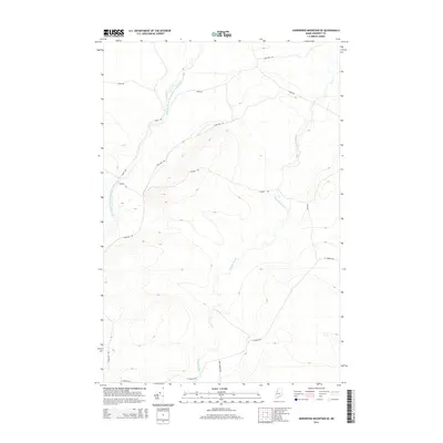
2014 Map of Hardwood Mountain SE
USGS Topo · Published 2014About this map
The Little Southwest Branch Saint John River winds through this heavily forested section of Somerset County, defining the drainage patterns of a landscape shaped by the timber industry and remote border-country travel. Modern forestry and access roads dominate the terrain, with Nine Mile Rd and St Aurelie Rd serving as the primary arteries through the highlands. These routes, along with secondary ways like Gilbert Rd and Dump Rd, provide a window into the infrastructure required for large-scale land management in the North Maine Woods during the early 21st century. Smaller waterways, including Brailey Brook, carve through the elevations, illustrating the complex hydrology that feeds the larger Saint John watershed. The map records a snapshot of a working landscape where industrial road names like Road 501 and Road 500 intersect with the natural flow of the river.
Find a feature on this map
9 named features on this map. Tap any name to fly to it.
Don’t see what you’re looking for? This feature index may not catch every label — zoom into the map to look around manually.
Map Details
Editions of this 2014 Hardwood Mountain SE Map
This is the sole edition of this map. No revisions or reprints were ever made.
Other maps of this area

1954 · Baker Lake
USGS Topo · 1:62,500

1954 · St. John Pond
USGS Topo · 1:62,500

1954 · Presque Isle
USGS Topo · 1:250,000

1957 · Norris Brook
USGS Topo · 1:62,500

1957 · Hardwood Mountain
USGS Topo · 1:62,500

1958 · Presque Isle
USGS Topo · 1:250,000

1958 · Saint John Pond
USGS Topo · 1:62,500

1960 · Presque Isle
USGS Topo · 1:250,000

1962 · Baker Lake
USGS Topo · 1:62,500

1962 · Quebec
USGS Topo · 1:250,000