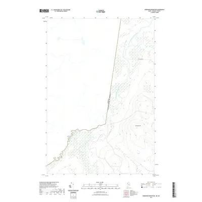
2021 Map of Hardwood Mountain
USGS Topo · Published 2021About this map
Southwest Branch Saint John River winds along the international boundary in this Somerset County survey, marking the topographical division between the United States and Canada. This landscape is defined by the significant rise of Hardwood Mtn, which dominates the southeastern portion of the quadrangle. The terrain here is intersected by Dead Brook and a limited network of timber-access routes, most notably Carter Brook Rd. The map illustrates a remote borderland where the natural hydrology of the Saint John River system dictated the placement of the international frontier, creating a distinct geographical profile of the Maine-Quebec line.
Find a feature on this map
5 named features on this map. Tap any name to fly to it.
Don’t see what you’re looking for? This feature index may not catch every label — zoom into the map to look around manually.
Map Details
Editions of this 2021 Hardwood Mountain Map
This is the sole edition of this map. No revisions or reprints were ever made.
Other maps of this area

1954 · Baker Lake
USGS Topo · 1:62,500

1954 · Presque Isle
USGS Topo · 1:250,000

1955 · Beaver Pond
USGS Topo · 1:62,500

1957 · Hardwood Mountain
USGS Topo · 1:62,500

1958 · Presque Isle
USGS Topo · 1:250,000

1960 · Presque Isle
USGS Topo · 1:250,000

1962 · Baker Lake
USGS Topo · 1:62,500

1962 · Quebec
USGS Topo · 1:250,000
1986 · Chamberlain Lake
USGS Topo · 1:100,000
1986 · Eastman Brook
USGS Topo · 1:24,000