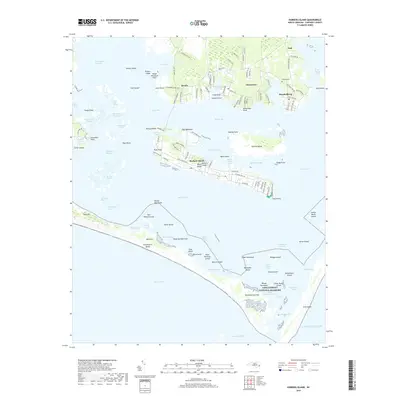
2019 Map of Harkers Island
USGS Topo · Published 2019About this map
Harkers Island and the neighboring mainland communities of Gloucester and Marshallberg define this coastal landscape where the Core Sound meets Back Sound. The intricate coastline is dotted with family-named landforms like Gaskill Point and Black Hammock Point, reflecting the deep maritime heritage of eastern Carteret County. To the south, the protective barrier of Shackleford Banks and the Cape Lookout National Seashore shield the inner sounds from the Atlantic Ocean.
Find a feature on this map
138 named features on this map. Tap any name to fly to it.
Don’t see what you’re looking for? This feature index may not catch every label — zoom into the map to look around manually.
Map Details
Editions of this 2019 Harkers Island Map
This is the sole edition of this map. No revisions or reprints were ever made.
Other maps of this area

1949 · Beaufort
USGS Topo · 1:24,000

1949 · Williston
USGS Topo · 1:24,000

1949 · Harkers Island
USGS Topo · 1:24,000

1949 · Davis
USGS Topo · 1:24,000

1949 · Core Creek
USGS Topo · 1:24,000

1950 · Horsepen Point
USGS Topo · 1:24,000

1951 · Williston
USGS Topo · 1:24,000
1951 · Davis
USGS Topo · 1:24,000

1951 · Core Creek
USGS Topo · 1:24,000
1951 · Beaufort
USGS Topo · 1:24,000