Old Maps of Carteret County, North Carolina
Explore 211 old maps of Carteret County, spanning from 1942 to today. These high-resolution historic maps reveal how streets, neighborhoods, landmarks, and natural features evolved over time — perfect for genealogy, metal detecting, research, and local history exploration.
What you can do with these maps:
- See how Carteret County changed over time: Compare historical maps to modern-day views to trace roads, homesites, rail lines & more.
- View detailed metadata: Each map includes creators, publishers, year, scale, and archive source.
- Overlay maps with satellite & LiDAR: Visualize the past alongside modern tools to explore terrain & human change.
- Trusted historical sources: Maps sourced from the USGS, Library of Congress, and other archives.
- Access maps your way: View online, download high-res files, or order prints for personal or research use.
Start exploring old maps of Carteret County to uncover forgotten places, hidden landmarks, and the deep history beneath your feet.
Carteret County, NC maps
(211)- 1942 Map of Maysville
 1942 Maysville1942 Print · USGSCoastal North Carolina during the early years of the war is captured here through its networks of swamp forests and river settlements. Genealogists and local historians can trace the rural landscape through White Oak Sch, the Hadnot Ch, and rail stops along the Atlantic Coast Line Railroad.
 - 1942 Map of Swansboro
 1942 Swansboro1942 Print · USGSThe North Carolina coast during the early 1940s reveals a world of intricate waterways and family-named landings before mid-century development. Genealogists and historians can trace old sites like Snead Ferry, Willis Landing, and the inland hub of Whitehouse Forks.
 - 1948 Map of Maysville
 1948 Maysville1948 Print · USGSCoastal North Carolina's river-fed lowlands come to life in this late-forties survey of the Jones and Onslow county borderlands. Genealogists and local historians can trace the rural landscape from Polloksville down to Stella, locating landmarks like Tabernacle Sch and Lees Ch.
 - 1948 Map of Swansboro
 1948 Swansboro1948 Print · USGSCoastal North Carolina's maritime character is preserved here in the late 1940s, centered on the historic waterfront at Swansboro. Researchers can trace the legacy of tidal commerce through numerous family-named sites like Willis Landing and Great Neck Landing.
 - 1948 Map of Portsmouth, 1976 Print
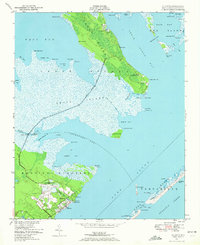
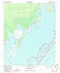
 1948 Portsmouth1976 Print · USGSThe Outer Banks at Portsmouth Island are captured here during the mid-1940s, showing a remote maritime community before modern coastal changes. Trace the docks at Portsmouth, find navigation aids like Shell Castle, and locate the ferry routes that linked these isolated shoals.2 unique versions available
 - 1948 Map of North Bay, 1976 Print
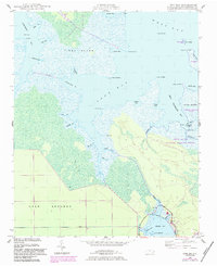
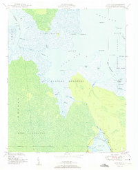
 1948 North Bay1976 Print · USGSCoastal Carteret County is captured here in the late 1940s, showing the intricate marshlands and islands between the sound and the bay. Researchers can trace old routes like Cedar Island Road to Goodwin Hills and Sandy Landing.
 - 1948 Map of Oriental, 1992 Print
 1948 Oriental1992 Print · USGSThe coastal waters of Pamlico County meet the riverfront during the post-war era, showing the maritime heart of the region. Local historians can trace the growth of Oriental and locate rural landmarks like Pilgrim Chapel, Whortonsville, and Bethel Ch.
 - 1949 Map of Beaufort, 1964 Print
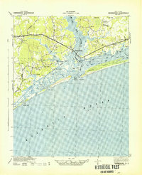
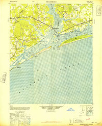
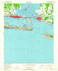 1949 Beaufort1964 Print · USGSCoastal Carteret County comes alive in the late 1940s, showing the developing waterfronts of Morehead City and Beaufort. Genealogists and historians can trace local landmarks like Bay View Cem, Fort Macon, and the Atlantic and East Carolina rail line.6 unique versions available
 - 1949 Map of Atlantic, 1972 Print
 1949 Atlantic1972 Print · USGSThe Carteret County coast in the late 1940s reveals a landscape of isolated marshland settlements and expanding military airfields. Genealogists and historians can trace family sites like Gilgo Cem or Roe School and locate the early layout of Atlantic Field.2 unique versions available
 - 1949 Map of Styron Bay, 1974 Print
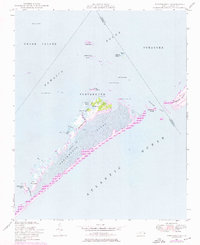
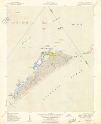
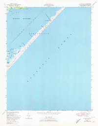 1949 Styron Bay1974 Print · USGSThe barrier islands and sound-side marshes of North Carolina are captured here just after the war, when the coastal landscape was defined by tide and channel. Trace the thin line of human presence along Portsmouth Bank S, from the Coast Guard Sta to the Carteret Rod and Gun Club.2 unique versions available
 - 1949 Map of Point Of Marsh, 1976 Print
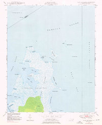 1949 Point Of Marsh1976 Print · USGSThe coastal marshes of Carteret County are documented here in the late 1940s, showing the meeting of the Neuse River and Pamlico Sound. Maritime researchers can trace the shoreline of Piney Island and locate remote navigation aids like Point of Marsh Lt and Cedar Island Bay Lt.3 unique versions available
 - 1949 Map of Long Bay, 1983 Print
 1949 Long Bay1983 Print · USGSCoastal Carteret County at mid-century is a network of tidal guts and marshes, from Piney Island to the Cedar Island refuge. Local historians can trace family markers at Isaiah Cem and find early maritime sites like Votive Camp and Cedar Island Light.2 unique versions available
 - 1949 Map of Merrimon, 1983 Print
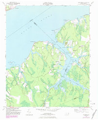 1949 Merrimon1983 Print · USGSCoastal life in mid-century North Carolina centered on the intricate waterways of the Neuse River and the Intracoastal route. Genealogists can trace family footprints through rural landmarks like Reels Chapel, Oak Grove Ch, and the Adams Creek Sch.
 - 1949 Map of Newport, 1983 Print
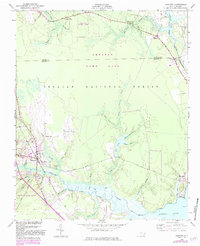 1949 Newport1983 Print · USGSCoastal Carteret County in the late 1940s is captured here at the edge of the great coastal forests and tidal rivers. Genealogists can trace the environs of Newport, finding specific local landmarks like Hymans Chapel, the Newport Cem, and the Prison Camp.
 - 1949 Map of Salter Path, 1983 Print
 1949 Salter Path1983 Print · USGSThe North Carolina coast comes into focus during the mid-century as traditional fishing villages and early barrier island developments began to expand. Trace family history and coastal change through Salter Path, Indian Beach, and the inland reaches of Broad Creek.
 - 1949 Map of Williston, 1984 Print
 1949 Williston1984 Print · USGSThe coastal hamlets of eastern North Carolina are captured here in the mid-forties, showing the maritime rhythm of life along Core Sound. Genealogists can trace family roots through the settlements of Otway, Bettie, and Smyrna, and find landmarks like Woodville Church.
 - 1949 Map of Harkers Island, 1984 Print
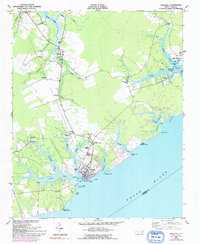
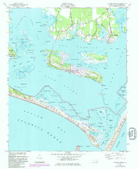 1949 Harkers Island1984 Print · USGSThe maritime communities of Carteret County are shown here during the late 1940s as traditional fishing villages and barrier islands. Researchers can trace family-named landmarks and coastal infrastructure from Gaskill Landing and Straits to the remote reaches of Shackleford Banks.2 unique versions available
 - 1949 Map of South River, 1984 Print
 1949 South River1984 Print · USGSCoastal Carteret County is defined by its deep estuaries and low-lying woods in the mid-twentieth century. Genealogists and historians can trace the remote settlement of Lukens and the South River community near landmarks like the South River Light and Turnpike Road.
 - 1949 Map of Mansfield, 1984 Print
 1949 Mansfield1984 Print · USGSCoastal Carteret County comes alive in this mid-century survey as Morehead City and Mansfield grow alongside the Bogue Sound. Genealogists and historians can trace mainland landmarks like St Marks Chapel or early development on the banks at Atlantic Beach.
 - 1949 Map of Davis, 1984 Print
 1949 Davis1984 Print · USGSCoastal Carteret County at mid-century is a landscape of maritime villages and expansive sound waters. Genealogists and historians can trace family locations near Stacey Cemetery, explore the docks at Davis Landing, or locate the Stacy School.2 unique versions available
 - 1949 Map of Core Creek, 1984 Print
 1949 Core Creek1984 Print · USGSCoastal Carteret County is mapped here in the mid-twentieth century as the maritime and timber economies shaped the shoreline. Genealogists and local researchers can trace early homesteads and community life through Crab Point Village, Tattles Grove Ch, and the Barge Landing Basin.2 unique versions available
 - 1949 Map of Masontown, 1984 Print
 1949 Masontown1984 Print · USGSCoastal North Carolina's pocosin wilderness and expanding rail-side settlements are captured here in the late 1940s. Genealogists and historians can trace the development of Havelock, Masontown, and Camp Bryan along the Atlantic and East Carolina railroad.
 - 1950 Map of Horsepen Point
 1950 Horsepen Point1950 Print · USGSThe North Carolina Outer Banks appear in their mid-century state, showing the narrow ribbon of Core Banks and the marshy expanse of Core Sound. Genealogists and maritime historians can trace family-named coastal features like Guthrie Hammock, Lewis Island, and Rawson Cr.
 - 1950 Map of Portsmouth
 1950 Portsmouth1950 Print · USGSThe Outer Banks village of Portsmouth is captured at mid-century, before it was completely vacated. Genealogists and maritime historians can trace the foundations of this island community and landmarks like Shell Castle, The High Hills, and Beacon Island.2 unique versions available
 - 1950 Map of Long Bay
 1950 Long Bay1950 Print · USGSThe Carteret County coast at mid-century was a wilderness of tidal marshes and remote island outposts. Researchers can trace historical navigation points like Cedar Island Light, the Isaiah Cem, and early camps such as Velvee Camp.2 unique versions available
Showing maps 1-25 of 211
Top cities of Carteret County
- Morehead City historical maps
- Newport historical maps
- Emerald Isle historical maps
- Cape Carteret historical maps
- Atlantic Beach historical maps
- Cedar Point historical maps
See more
Frequently asked questions
- What are the different types of historical maps available for Carteret County?
- What is the oldest map of Carteret County?
- Where can I purchase historical maps of Carteret County for my home or office?
- Where can I download high-res historical maps of Carteret County?
- Are there historical topographic maps available for Carteret County?
- Is there historical aerial imagery available for Carteret County?
- Where are historical maps of Carteret County sourced from?