1950s Maps of Carteret County, North Carolina
Explore 27 historic maps of Carteret County from the 1950s. These maps offer a rare glimpse into what life looked like during the 1950s — showing old roads, neighborhoods, homes, and landmarks that have changed or disappeared over time.
Whether you're researching your family's past, planning a metal detecting trip, or studying how Carteret County's landscape evolved across the 1950s, these high-resolution maps are a powerful tool for exploring the history of this region.
- Focus on a specific era: All maps on this page are from the 1950s, giving you a focused view of this time period.
- See what’s changed: Compare century-old streets, trails, and buildings to today's modern landscape using overlays and satellite layers.
- Research with precision: Use these maps for genealogy, historical research, land use analysis, or educational projects.
- View, download, or print: Maps are fully viewable online in high resolution, and can be downloaded or printed for your own records.
Start exploring Carteret County's history through authentic maps from the 1950s. This is your window into the past.
Carteret County, NC maps
(27)- 1950 Map of Horsepen Point
 1950 Horsepen Point1950 Print · USGSThe North Carolina Outer Banks appear in their mid-century state, showing the narrow ribbon of Core Banks and the marshy expanse of Core Sound. Genealogists and maritime historians can trace family-named coastal features like Guthrie Hammock, Lewis Island, and Rawson Cr.
 - 1950 Map of Portsmouth
 1950 Portsmouth1950 Print · USGSThe Outer Banks village of Portsmouth is captured at mid-century, before it was completely vacated. Genealogists and maritime historians can trace the foundations of this island community and landmarks like Shell Castle, The High Hills, and Beacon Island.2 unique versions available
 - 1950 Map of Long Bay
 1950 Long Bay1950 Print · USGSThe Carteret County coast at mid-century was a wilderness of tidal marshes and remote island outposts. Researchers can trace historical navigation points like Cedar Island Light, the Isaiah Cem, and early camps such as Velvee Camp.2 unique versions available
 - 1950 Map of South River
 1950 South River1950 Print · USGSCoastal Carteret County at mid-century reveals a landscape of isolated fishing hamlets and vast marshy reaches along the Neuse River. Researchers can locate vanished points like Lukens or the oddly-named Nowhere, and trace water-borne life near South River Light.
 - 1950 Map of North Bay
 1950 North Bay1950 Print · USGSCoastal Carteret County is mapped here in the late Forties, showing the intricate marshlands and sound-side islands of the Outer Banks region. Genealogists and historians can trace traditional landforms and landings including Sandy Landing, Goodwin Hills, and Hog Island.
 - 1950 Map of Point Of Marsh
 1950 Point Of Marsh1950 Print · USGSThe Outer Banks and Pamlico Sound waters come to life in this mid-century survey of the North Carolina coast. Marine historians and local researchers can trace the intricate shorelines of Piney Island and Hunting Quarters, or locate old navigation aids like Point of Marsh Lt.
 - 1951 Map of Williston
 1951 Williston1951 Print · USGSCoastal Carteret County is captured here in the early fifties, showing a landscape of tidal marshes and established water-side settlements. Genealogists can trace family footprints in Smyrna, Williston, and Bettie, or locate landmarks like Woodville Church and Middens.
 - 1951 Map of Atlantic
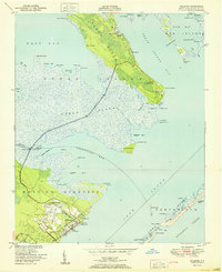 1951 Atlantic1951 Print · USGSCoastal Carteret County at the start of the fifties shows a resilient maritime landscape of island settlements and shifting inlets. Genealogists and historians can trace family-named sites like Gigo Cem, the Roe School, and remote fishing outposts at Ira Morris Camp.
 - 1951 Map of Salter Path
 1951 Salter Path1951 Print · USGSCoastal life in the early fifties centers on the narrow strip of Bogue Banks and the mainland woods of the Croatan National Forest. Trace the origins of Salter Path or find old landings and landmarks like Yellow Hill Landing and Nine Foot Road.2 unique versions available
 - 1951 Map of Davis
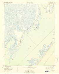 1951 Davis1951 Print · USGSFishing and hunting communities along the Core Sound were thriving mid-century as this area of the Outer Banks maintained its maritime character. Genealogists can trace family landmarks like Masontown, Murphy Cem, and the Stacy School.2 unique versions available
 - 1951 Map of Newport
 1951 Newport1951 Print · USGSCoastal North Carolina during the early fifties reveals a landscape of tidal rivers and timberlands within the Croatan National Forest. Researchers can trace old family sites and local landmarks like Hymans Chapel, the Prison Camp, and the historic rail line at Newport.3 unique versions available
 - 1951 Map of Core Creek
 1951 Core Creek1951 Print · USGSCoastal Carteret County in the early fifties shows a landscape defined by the Intracoastal Waterway and the Croatan National Forest. Genealogists can locate family landmarks like Crab Point Village and several country churches, including Live Oak Grove Ch and Freewill Ch.3 unique versions available
 - 1951 Map of Brant Island
 1951 Brant Island1951 Print · USGSThe Pamlico Sound coastline comes into focus during the early fifties, showing the maritime boundaries of Carteret and Pamlico Counties. Trace the land-and-water interface at Brant Island, the marshes of Hunting Quarters, and the shores of Cedar Island.2 unique versions available
 - 1951 Map of Merrimon
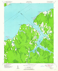 1951 Merrimon1951 Print · USGSCoastal North Carolina's maritime character is on full display in the mid-century as the Intracoastal Waterway cuts through the lowlands of Craven and Carteret counties. Genealogy researchers can trace family landmarks and rural community centers like Reels Chapel, Merrimon Ch, and Adams Creek Sch.2 unique versions available
 - 1951 Map of Styron Bay
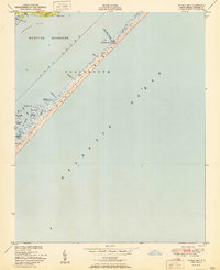 1951 Styron Bay1951 Print · USGSThe Outer Banks near Styron Bay are captured here in the early fifties, showing a fragile maritime landscape before modern development. Researchers can trace the isolated Coast Guard Sta and the Carteret Rod and Gun Club along the thin stretch of Portsmouth Bank S.
 - 1951 Map of Peltier Creek
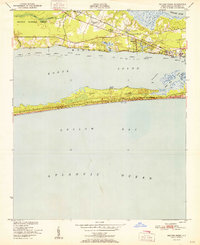 1951 Peltier Creek1951 Print · USGSCoastal Carteret County in the early fifties reveals a landscape of maritime forests and quiet railroad hamlets before the boom of modern beach development. Trace the early footprints of Morehead City Airport and Camp Morehead, or locate family sites near Wildwood and St Marks Chapel.2 unique versions available
 - 1951 Map of Beaufort
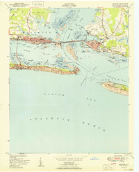 1951 Beaufort1951 Print · USGSCoastal Carteret County thrives as a maritime and rail hub in the years following the second World War. Genealogists and local historians can trace family-named landmarks like Willis Point and Steep Pines Fork, or locate institutional anchors like U.S. Marine Biological Station.2 unique versions available
 - 1951 Map of Harkers Island
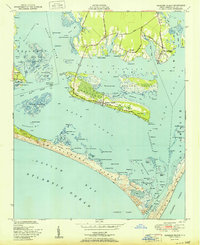 1951 Harkers Island1951 Print · USGSThe coastal waters of Carteret County appear here in the early fifties, detailing the maritime villages and shifting shoals of the Outer Banks. Researchers can trace family-named points and early infrastructure from Marshallberg to the Cem and ruins of Harkers Island.2 unique versions available
 - 1951 Map of Masontown
 1951 Masontown1951 Print · USGSCoastal North Carolina during the early 1950s reveals a landscape of managed wetlands and isolated settlements within the Croatan National Forest. Local historians can trace old transit routes like the Nine Foot Road and locate rural communities at Masontown and Holly Springs.3 unique versions available
 - 1951 Map of Cape Lookout
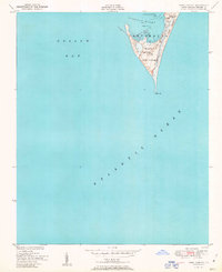 1951 Cape Lookout1951 Print · USGSThe Outer Banks come into sharp focus in the early fifties, centering on the vital maritime outpost of Cape Lookout. Trace the position of the Cape Lookout Lighthouse, the U. S. Coast Guard Sta Radio Towers, and the isolated landmarks of Core Banks.
 - 1951 Map of Broad Creek
 1951 Broad Creek1951 Print · USGSThe coastal marshes of Carteret and Pamlico Counties are captured here just after mid-century, where the Neuse River meets the Sound. Genealogists and local historians can trace family land near Florence, Zion Hill Ch, and the winding Swan Creek.4 unique versions available
 - 1952 Map of Hubert, 1954 Print
 1952 Hubert1954 Print · USGSThe Onslow County coast appears in the early fifties as a landscape of military reservations and tide-water settlements. Trace old family sites and maritime routes near Swansboro, Piney Grove Ch, and the many docks at Shell Rock Landing.3 unique versions available
 - 1952 Map of Swansboro, 1954 Print
 1952 Swansboro1954 Print · USGSCoastal North Carolina at the midpoint of the century reveals a landscape defined by its waterways and a growing military footprint. Genealogists and historians can trace family locations near Swansboro, locate the Bogue Sch, or study the layout of Bogue Airfield and the Coast Guard Station.4 unique versions available
 - 1953 Map of Rocky Mount, 1964 Print
 1953 Rocky Mount1964 Print · USGSEastern North Carolina in the mid-fifties is defined by its deep river basins and the vast wetlands of the Tidewater. Genealogists can trace family roots through hubs like Kinston and New Bern or explore the wilderness of Pettigrew State Park and Lake Mattamuskeet.4 unique versions available
 - 1953 Map of Beaufort, 1965 Print
 1953 Beaufort1965 Print · USGSThe North Carolina coastline in the mid-fifties reveals an era of massive military expansion alongside traditional maritime life. Genealogists can trace family names and small settlements from Sealevel to Sneads Ferry or locate landmarks like Fort Macon.3 unique versions available
Showing maps 1-25 of 27
Top cities of Carteret County
- Morehead City historical maps
- Newport historical maps
- Emerald Isle historical maps
- Cape Carteret historical maps
- Atlantic Beach historical maps
- Cedar Point historical maps
See more
Frequently asked questions
- What are the different types of historical maps available for Carteret County?
- What is the oldest map of Carteret County?
- Where can I purchase historical maps of Carteret County for my home or office?
- Where can I download high-res historical maps of Carteret County?
- Are there historical topographic maps available for Carteret County?
- Is there historical aerial imagery available for Carteret County?
- Where are historical maps of Carteret County sourced from?