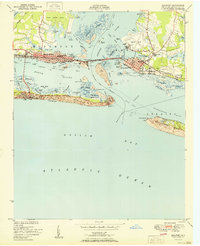
1951 Map of Beaufort
USGS Topo · Published 1951About this map
Morehead City and Beaufort are documented here at a mid-century moment when the rail-and-water economy defined coastal Carteret County. The Atlantic and East Carolina railroad connects the mainland to the busy port terminals while The Causeway links the two historic towns across the Newport River. The map shows a landscape shaped by maritime navigation, with intricate channels like Gallant Channel and Bulkhead Channel carving through marshes and islands.
Find a feature on this map
70 named features on this map. Tap any name to fly to it.
Don’t see what you’re looking for? This feature index may not catch every label — zoom into the map to look around manually.
Map Details
Editions of this 1951 Beaufort Map
2 editions found
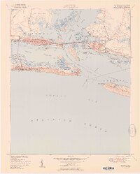
Other maps of this area

1949 · Beaufort
USGS Topo · 1:24,000

1949 · Newport
USGS Topo · 1:24,000

1949 · Williston
USGS Topo · 1:24,000

1949 · Harkers Island
USGS Topo · 1:24,000

1949 · Mansfield
USGS Topo · 1:24,000

1949 · Core Creek
USGS Topo · 1:24,000

1951 · Williston
USGS Topo · 1:24,000

1951 · Newport
USGS Topo · 1:24,000

1951 · Core Creek
USGS Topo · 1:24,000
1951 · Peltier Creek
USGS Topo · 1:24,000