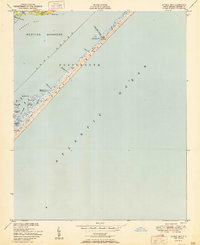
1951 Map of Styron Bay
USGS Topo · Published 1951About this map
The narrow ribbon of Portsmouth Bank S stretches between the Atlantic Ocean and the sheltered waters of Core Sound in this mid-century coastal survey. This portion of the Outer Banks demonstrates the fragile relationship between land and sea, where a single Telephone Line serves as the only infrastructure connecting isolated maritime outposts. Notable human activity is centered at the Coast Guard Sta near Cross Shoal Channel and the Carteret Rod and Gun Club to the south.
Find a feature on this map
26 named features on this map. Tap any name to fly to it.
Don’t see what you’re looking for? This feature index may not catch every label — zoom into the map to look around manually.
Map Details
Editions of this 1951 Styron Bay Map
This is the sole edition of this map. No revisions or reprints were ever made.
Other maps of this area

1949 · Atlantic
USGS Topo · 1:24,000

1949 · Styron Bay
USGS Topo · 1:24,000

1949 · Long Bay
USGS Topo · 1:24,000

1949 · Davis
USGS Topo · 1:24,000

1950 · Horsepen Point
USGS Topo · 1:24,000

1950 · Long Bay
USGS Topo · 1:24,000
1951 · Atlantic
USGS Topo · 1:24,000
1951 · Davis
USGS Topo · 1:24,000

1953 · Beaufort
USGS Topo · 1:250,000

1954 · Beaufort
USGS Topo · 1:250,000