1949 Map of Styron Bay
USGS Topo · Published 1974About this map
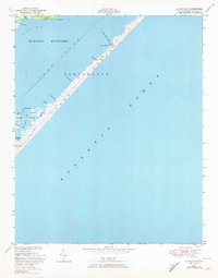
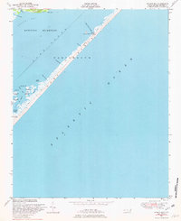
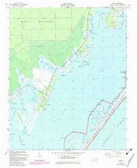
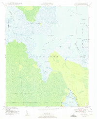
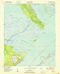
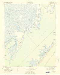
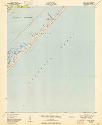
Portsmouth Bank S stretches diagonally across this mid-century maritime survey, separating the volatile Atlantic Ocean from the protected waters of Core Sound. This narrow barrier island environment is defined by its small tidal features and maritime infrastructure, notably the Coast Guard Sta and the Telephone Line that runs the length of the banks. The map reveals the intricate nature of the Inner Banks' sounds, where Hunting Quarters and Styron Bay provide shelter behind marshy points like Steep Point.
Find a feature on this map
27 named features on this map. Tap any name to fly to it.
Don’t see what you’re looking for? This feature index may not catch every label — zoom into the map to look around manually.
Map Details
Editions of this 1949 Styron Bay Map
2 editions found
Other maps of this area
1949 · Atlantic
USGS Topo · 1:24,000
1949 · Long Bay
USGS Topo · 1:24,000
1949 · Davis
USGS Topo · 1:24,000

1950 · Horsepen Point
USGS Topo · 1:24,000
1950 · Long Bay
USGS Topo · 1:24,000
1951 · Atlantic
USGS Topo · 1:24,000
1951 · Davis
USGS Topo · 1:24,000
1951 · Styron Bay
USGS Topo · 1:24,000

1953 · Beaufort
USGS Topo · 1:250,000

1954 · Beaufort
USGS Topo · 1:250,000