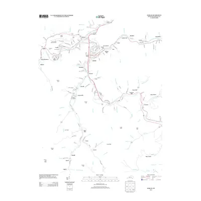
2013 Map of Harlan
USGS Topo · Published 2013About this map
Harlan serves as the focal point for this mountain landscape where the Cumberland River is formed by the confluence of the Poor Fork Cumberland River, Clover Fork Cumberland River, and Martins Fork Cumberland River. This intricate drainage system dictates the placement of numerous small settlements and mining communities, including Harlan Gas, Clovertown, and Blackjoe. The area's industrial and residential layout follows the narrow valley floors, bounded by prominent terrain features such as Howard Cliff and Sukey Ridge.
Find a feature on this map
142 named features on this map. Tap any name to fly to it.
Don’t see what you’re looking for? This feature index may not catch every label — zoom into the map to look around manually.
Map Details
Editions of this 2013 Harlan Map
This is the sole edition of this map. No revisions or reprints were ever made.
Other maps of this area

1887 · Jonesville
USGS Topo · 1:125,000

1891 · Jonesville
USGS Topo · 1:125,000

1903 · Harlan
USGS Topo · 1:48,000

1916 · Harlan
USGS Topo · 1:48,000

1916 · Nolansburg
USGS Topo · 1:48,000

1919 · Nolansburg
USGS Topo · 1:62,500

1919 · Harlan
USGS Topo · 1:62,500

1932 · Hagan
USGS Topo · 1:62,500
1935 · Ewing
USGS Topo · 1:24,000

1935 · Hubbard Springs
USGS Topo · 1:24,000