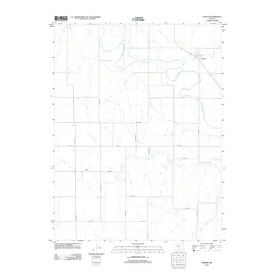
2012 Map of Harlan
USGS Topo · Published 2012About this map
The settlement of Harlan sits along the northern edge of the N Fork Solomon River valley, serving as a focal point for this agrarian landscape in Smith County. The river winds across the northern half of the sheet, joined by Spring Cr as it carves through the undulating plains. Further south, the terrain is defined by the drainage systems of Lawrence Cr and Joy Cr, which create a series of shallow valleys and draws. For genealogists and local historians, the Butler Cem stands as a significant landmark in the western portion of the quadrangle. The map documents a rigid grid of rural roads, including Co RD-362 and S 180th Ave, illustrating the enduring nature of the section-line transport system in this part of Kansas.
Find a feature on this map
21 named features on this map. Tap any name to fly to it.
Don’t see what you’re looking for? This feature index may not catch every label — zoom into the map to look around manually.
Map Details
Editions of this 2012 Harlan Map
This is the sole edition of this map. No revisions or reprints were ever made.
Other maps of this area

1893 · Smith Center
USGS Topo · 1:125,000

1896 · Osborne
USGS Topo · 1:125,000

1953 · Bloomington
USGS Topo · 1:24,000

1953 · Osborne
USGS Topo · 1:24,000

1953 · Alton
USGS Topo · 1:24,000

1955 · Beloit
USGS Topo · 1:250,000

1959 · Beloit
USGS Topo · 1:250,000

1961 · Portis
USGS Topo · 1:24,000

1961 · Harlan
USGS Topo · 1:24,000

1961 · Gaylord SW
USGS Topo · 1:24,000