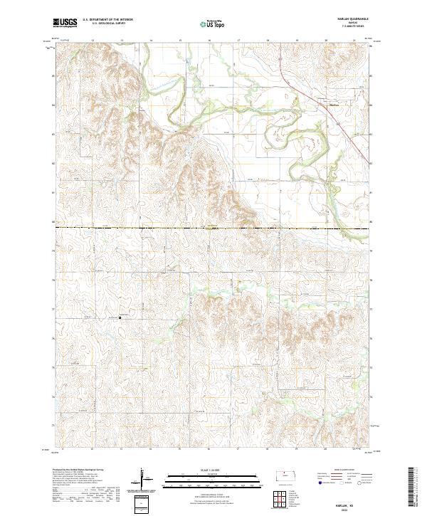
2022 Map of Harlan
USGS Topo · Published 2022About this map
The North Fork Solomon River defines the northern landscape of this region, winding through the valley where the settlement of Harlan is situated. The terrain transition is marked by a network of drainage systems including Spring Cr, Lawrence Cr, and Joy Cr, which carve into the plains across the border of Smith and Osborne counties. For local historians and genealogists, the placement of Butler Cem provides a specific point of reference in the rural sections south of the river. The grid-based road system, including routes like Co RD 362 and W 40th DR, illustrates the persistent township and range structure that has organized this Kansas agricultural landscape for generations.
Find a feature on this map
23 named features on this map. Tap any name to fly to it.
Don’t see what you’re looking for? This feature index may not catch every label — zoom into the map to look around manually.
Map Details
Editions of this 2022 Harlan Map
This is the sole edition of this map. No revisions or reprints were ever made.
Other maps of this area

1893 · Smith Center
USGS Topo · 1:125,000

1896 · Osborne
USGS Topo · 1:125,000

1953 · Bloomington
USGS Topo · 1:24,000

1953 · Osborne
USGS Topo · 1:24,000

1953 · Alton
USGS Topo · 1:24,000

1955 · Beloit
USGS Topo · 1:250,000

1959 · Beloit
USGS Topo · 1:250,000

1961 · Portis
USGS Topo · 1:24,000

1961 · Harlan
USGS Topo · 1:24,000

1961 · Gaylord SW
USGS Topo · 1:24,000