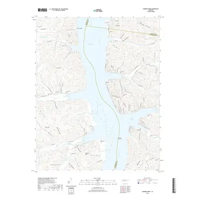
2019 Map of Harmon Creek
USGS Topo · Published 2019About this map
Kentucky Lake and the Tennessee River dominate this landscape, creating a complex network of inlets and harbors where Benton, Houston, and Humphreys counties meet. The flooded topography has transformed former valleys into significant water bodies like Richland Harbor, while leaving prominent heights such as Highstand Ridge and High Place as overlook points. This 2019 survey documents a region defined by its narrow hollows and numerous family-named cemeteries that speak to the long-standing community roots along the riverbanks.
Find a feature on this map
110 named features on this map. Tap any name to fly to it.
Don’t see what you’re looking for? This feature index may not catch every label — zoom into the map to look around manually.
Map Details
Editions of this 2019 Harmon Creek Map
This is the sole edition of this map. No revisions or reprints were ever made.
Other maps of this area

1936 · Poplar Creek
USGS Topo · 1:24,000

1936 · McKinnon
USGS Topo · 1:24,000

1936 · Camden
USGS Topo · 1:24,000

1936 · Big Sandy
USGS Topo · 1:24,000

1936 · Stewart
USGS Topo · 1:24,000

1936 · Halls Creek
USGS Topo · 1:24,000

1936 · Johnsonville
USGS Topo · 1:24,000

1936 · Harmon Creek
USGS Topo · 1:24,000

1936 · Waverly
USGS Topo · 1:24,000

1949 · Harmon Creek
USGS Topo · 1:24,000