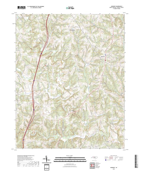
2022 Map of Harmony
USGS Topo · Published 2022About this map
Harmony and Turnersburg anchor this northern Iredell County landscape where the South Yadkin River forms the southern boundary. The terrain is defined by a dense network of waterways, including Rocky Creek, Dutchman Cr, and Patterson Creek, which have shaped the settlement patterns of agricultural communities like Olin and Williamsburg. Local transportation is dominated by a mix of historic rural routes and modern connectors, such as State Rd 1886 and State Rd 1889, which weave through the rolling topography. The presence of Stoneriver Airport near the southern riverbend indicates the region's modern aviation footprint amidst its long-standing rural character. Genealogists and local historians can trace family-named roads like Mitchell Farm Rd and Blackwelder Rd to understand the spatial history of the area's landownership and development.
Find a feature on this map
120 named features on this map. Tap any name to fly to it.
Don’t see what you’re looking for? This feature index may not catch every label — zoom into the map to look around manually.
Map Details
Editions of this 2022 Harmony Map
This is the sole edition of this map. No revisions or reprints were ever made.
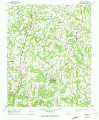
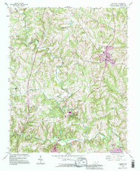
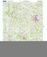
Historical Maps of Olin Through Time
4 maps found