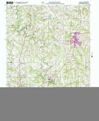
2000 Map of Harmony
USGS Topo · Published 2002About this map
The South Yadkin River flows along the southern edge of this landscape, anchoring a rural Iredell County region defined by small, dispersed settlements and a network of creeks. Small villages like Harmony and Turnersburg serve as local hubs, while smaller crossroads such as Williamsburg, Olin, and Patterson provide a glimpse into the historic settlement patterns of the Piedmont. The terrain is characterized by the divide between several watercourses, including Rocky Creek, Dutchman Creek, and Kinder Creek. Genealogy and local history researchers will find a significant number of landmarks, from established congregations at Macedonia Ch and Hebron Ch to North Iredell High Sch. Cultural features like Old Grade Road suggest the evolution of the local transportation network through a landscape of rolling hills and isolated rises such as Mount Nebo.
Find a feature on this map
34 named features on this map. Tap any name to fly to it.
Don’t see what you’re looking for? This feature index may not catch every label — zoom into the map to look around manually.
Map Details
Editions of this 2000 Harmony Map
This is the sole edition of this map. No revisions or reprints were ever made.
Other maps of this area

1891 · Yadkinville
USGS Topo · 1:125,000

1893 · Statesville
USGS Topo · 1:125,000

1893 · Yadkinville
USGS Topo · 1:125,000

1953 · Charlotte
USGS Topo · 1:250,000

1953 · Winston-Salem
USGS Topo · 1:250,000

1954 · Charlotte
USGS Topo · 1:250,000

1955 · Winston-Salem
USGS Topo · 1:250,000

1960 · Charlotte
USGS Topo · 1:250,000

1962 · Winston-Salem
USGS Topo · 1:250,000

1962 · Charlotte
USGS Topo · 1:250,000