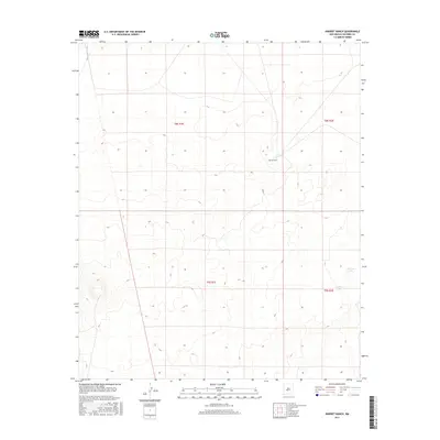
2017 Map of Harriet Ranch
USGS Topo · Published 2017About this map
Harriet Ranch stands as the primary landmark in this expanse of Socorro County, New Mexico. The landscape is defined by its arid character and limited water resources, marked primarily by Lambing Lake and Lambing Tank in the southeastern quadrant. This survey illustrates the sparse ranching infrastructure and land management patterns of the early 21st century, where large tracts are defined by the Public Land Survey System. The topography reveals a series of subtle depressions and drainage patterns typical of the high desert basin, highlighting the isolation of these remote ranching outposts.
Find a feature on this map
7 named features on this map. Tap any name to fly to it.
Don’t see what you’re looking for? This feature index may not catch every label — zoom into the map to look around manually.
Map Details
Editions of this 2017 Harriet Ranch Map
This is the sole edition of this map. No revisions or reprints were ever made.
Other maps of this area

1916 · Salinas Peak
USGS Topo · 1:125,000

1948 · Granjean Well
USGS Topo · 1:62,500

1948 · Val Verde
USGS Topo · 1:62,500

1948 · Malpais Well
USGS Topo · 1:62,500

1948 · Salinas Peak
USGS Topo · 1:62,500

1954 · Tularosa
USGS Topo · 1:250,000

1958 · Tularosa
USGS Topo · 1:250,000

1981 · Granjean Well
USGS Topo · 1:24,000

1981 · Tularosa
USGS Topo · 1:100,000
1981 · Blakemore Well
USGS Topo · 1:24,000