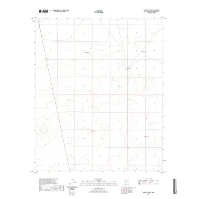
2020 Map of Harriet Ranch
USGS Topo · Published 2020About this map
Harriet Ranch Headquarters serves as the central landmark in this portion of Socorro County, representing the isolated ranching operations characteristic of the High Desert landscape in central New Mexico. The terrain is marked by subtle drainage patterns and seasonal water catchments, including Lambing Lake and the Lambing Tank located in the southeastern quadrant. This 2020 survey documents the modern land divisions of the Public Land Survey System, specifically within Townships 8 South Range 1 East, 8 South Range 2 East, 9 South Range 1 East, and 9 South Range 2 East. The area is largely defined by its open range and lack of dense infrastructure, preserving a snapshot of the contemporary ranching economy and the sparse network of local connectors that traverse the arid plains.
Find a feature on this map
7 named features on this map. Tap any name to fly to it.
Don’t see what you’re looking for? This feature index may not catch every label — zoom into the map to look around manually.
Map Details
Editions of this 2020 Harriet Ranch Map
This is the sole edition of this map. No revisions or reprints were ever made.
Other maps of this area

1916 · Salinas Peak
USGS Topo · 1:125,000

1948 · Granjean Well
USGS Topo · 1:62,500

1948 · Val Verde
USGS Topo · 1:62,500

1948 · Malpais Well
USGS Topo · 1:62,500

1948 · Salinas Peak
USGS Topo · 1:62,500

1954 · Tularosa
USGS Topo · 1:250,000

1958 · Tularosa
USGS Topo · 1:250,000

1981 · Granjean Well
USGS Topo · 1:24,000

1981 · Tularosa
USGS Topo · 1:100,000
1981 · Blakemore Well
USGS Topo · 1:24,000